Check Out Our Holiday Auction!

Observation: James Peak

Observation Date
12/10/2025
Observer Name
UAC Staff
Region
Ogden » Powder Mountain Backcountry » James Peak
Location Name or Route
Powder Mountain Periphery
Weather
Sky
Broken
Wind Direction
Northwest
Wind Speed
Light
Weather Comments
Too warm for December 10.
Snow Characteristics
Snow Surface Conditions
Damp
Snow Characteristics Comments

There is generally 15-30 cms (6-12 inches) of coverage above 8,500 feet, with up to ~45 cms (18 inches) in wind-drifted areas. Snowpack is moist from top to bottom.

Red Flags
Red Flags
Poor Snowpack Structure
Red Flags Comments
The layer of facets at the ground from November snow is shallow - at most 15 cms (6 inches) and was moist everywhere we looked, but we were still able to get full propagation with extended column tests, and one collapse on a wind-loaded slope. More on this below.
Avalanche Problem #1
Problem
Persistent Weak Layer
Trend
Decreasing Danger
Problem #1 Comments

The shallow faceted down near the ground is loose, but damp. Full propagation with an extended column test which failed at this layer initially, on ECTP3, and then ECTP8 and ECTP11.

Comments

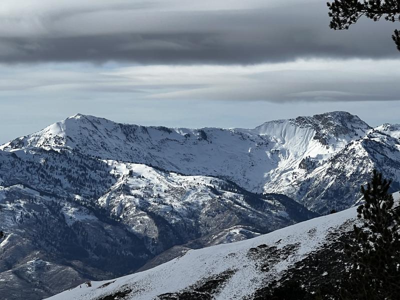
Most everywhere we traveled in the backcountry adjacent to Powder Mountain had a Low danger with shallow coverage, but there are isolated areas that have a deeper snowpack due to wind-drifting that had a Moderate danger where the slab is stronger and the facets weaker. Looking across the Ogden Valley, Ben Lomond and Willard Peak have what seems a deeper snowpack, so the danger may be Moderate and more wide-spread.

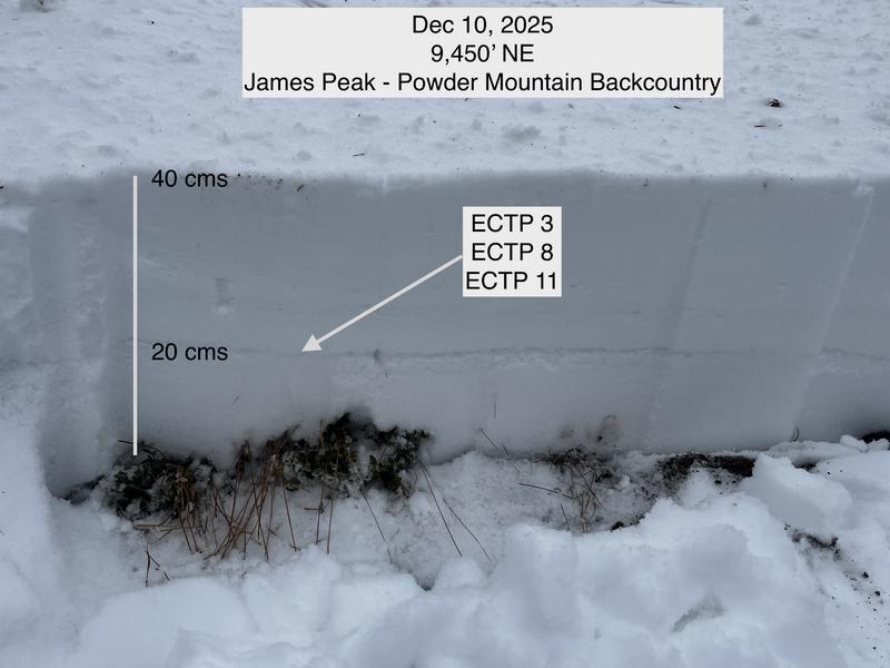
We're not used to this kind of weather and snowpack structure in December, with a shallow, faceted snowpack that is damp/moist. With warm temperatures forecast for the next several days, it is possible we could have wet snow issues that gouge down to the faceted layer at the ground.

Photos of

- Ogden Skyline between Ben Lomond and Willard Peak

- Pit at 9,450 on NE aspect with full propagation

Video
Today's Observed Danger Rating
Moderate
Tomorrows Estimated Danger Rating
Moderate
Coordinates