Check Out Our Holiday Auction!

Observation: Scotts Backdoor

Observation Date
12/5/2025
Observer Name
Champion & Collett
Region
Salt Lake » Park City Ridgeline » Scotts Backdoor
Location Name or Route
Scotts Pass/Scotts Backdoor
Weather
Sky
Overcast
Precipitation
Light Snowfall
Wind Direction
West
Wind Speed
Light
Weather Comments
Overcast day with light precipitation and very little accumulation. Winds backed off throughout the day, becoming generally light along the ridgelines by 3 PM.
Snow Characteristics
New Snow Depth
1"
New Snow Density
Medium
Snow Surface Conditions
Powder
Rain-Rime Crust
Snow Characteristics Comments

Very little new snow accumulation along the Park City ridgeline, with totals appearing to be around an inch, maybe 1.5" by the time we skied out. The snow surface was a variety of textures, with a rain-rime crust in places and strong riming along all surfaces.

Rain-rime crust - West Aspect - 9000'

Red Flags
Red Flags
Poor Snowpack Structure
Avalanche Problem #1
Problem
Persistent Weak Layer
Trend
Increasing Danger
Problem #1 Comments

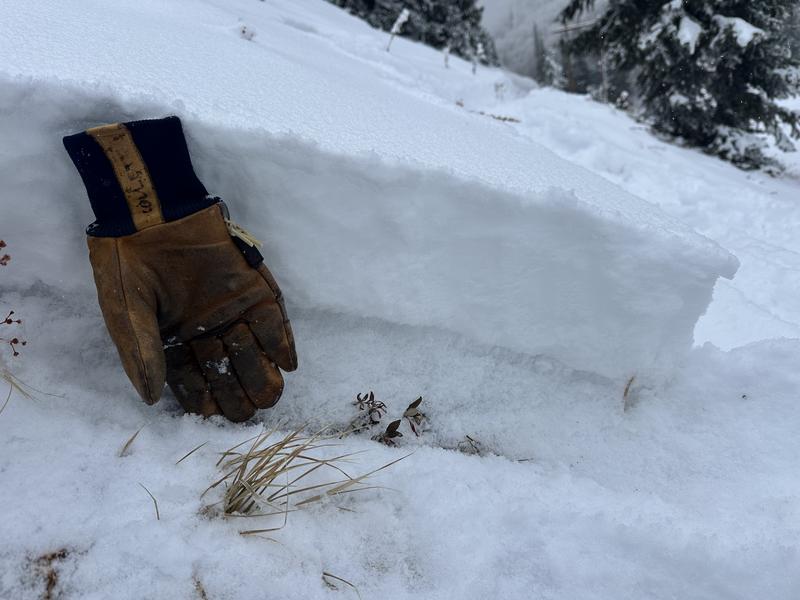
The primary issue is the poor snowpack structure. We traveled on both NE, and NW facing aspects above 9700' and in both places found a very similar, shallow snowpack structure.

We found about 30 cm of snow, a little deeper in the wind drifts, with the lower 10 to 15 cm made up of weak facets. It is a shallow and fragile setup, and along the Park City ridgeline most slopes were still missing a real slab. Even the small wind drifts were too soft to act like one.

The problem will really show up once a slab forms on top of this layer. That could happen with new snow if we end up on the higher end of the forecast, or with a combination of new snow and strong winds. If we get a slab on top of this layer, avalanche danger will rise.

The good news is that terrain management goes a long way here. The south side of the compass is still pretty bony, but it does not have that weak faceted base. If we get heavier snowfall, you can manage this issue by sticking to southerly grassy slopes or by staying off slopes steeper than 30 degrees on the north side of the compass.

Snowpack structure - NE Aspect - 9700' - PC Ridgeline - the dark grey layer along the bottom is 10cm of facets.

Avalanche Problem #2
Problem
Wind Drifted Snow
Trend
Increasing Danger
Problem #2 Comments

The only real areas of concern along the Park City ridgeline were spots where you could find a more cohesive wind drift. Having a cohesive slab seems to be the key right now. With the incoming front and the forecast for strong winds, I expect this issue to grow.

Today's Observed Danger Rating
Moderate
Tomorrows Estimated Danger Rating
Considerable
Coordinates