Observation Date
3/25/2025
Observer Name
Zimmerman-Wall/Kelly/Woody
Region
Provo » Provo Canyon » South Fork Provo R. » Big Springs
Location Name or Route
Cascade-Big Springs
Comments
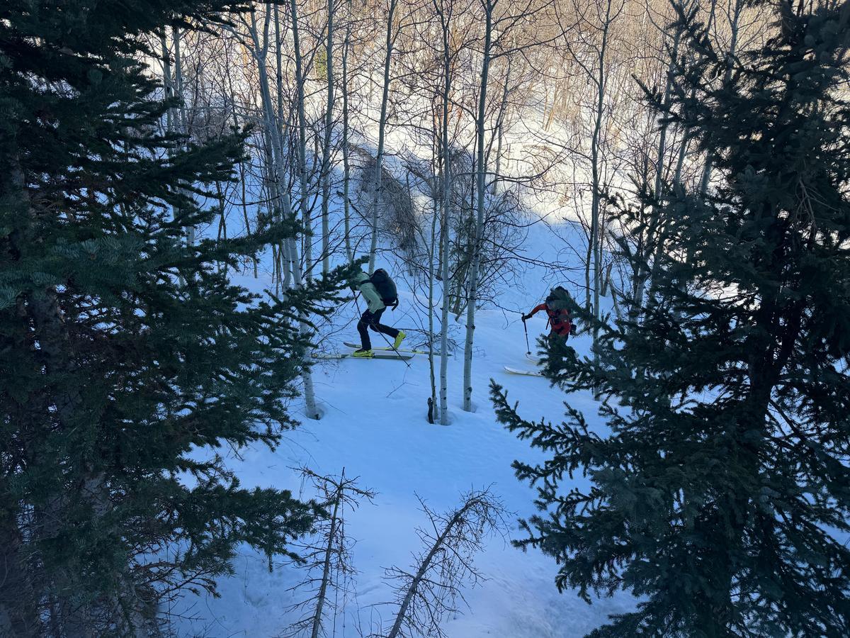
Plenty of wet snow related destruction across the Upper Big Springs and Bunnells drainages on the East side of the Cascade Ridge. The tour provided ample opportunity for group discussions of wet snow avalanche hazard. As a group of three we managed the issues through timing, using a variety of travel techniques, and taking advantage of relatively cooler aspects with transit-able sub-ridges when appropriate. Even still, we occasionally exposed ourselves to slopes capable of producing large avalanches. Bearing witness to the phasic changes of a spring snowpack provided powerful learning for each of us in different ways and it was a good remainder to maintain your ability to be surprised.
Photos:
Big Springs- Bowl 1 Low - Wet Loose
Big Springs Bowl 1 Low- > Human-size roller ball
Bunnells- White Limbo Cliffs and Middle Bowl. One of the cornices along the North Peak is what released and pulled out the hanging snowfield below. Photo at 10am.
Big Springs- Big Bowl 2 - Cornices and Wet Loose
Big Springs- Big Bowl 2 - Skier triggered Sheets of Wet Loose
Big Springs - Big Bowl 2- Numerous Wet Loose, natural and skier triggered
Big Springs - Ridge between Big Bowl 1 + 2- Skier triggered Wet Loose
Big Springs Big Bowl 3 - Old Persistent Slab below rock band had not filled in totally with the last storm
Photo of Bunnells Weather Station
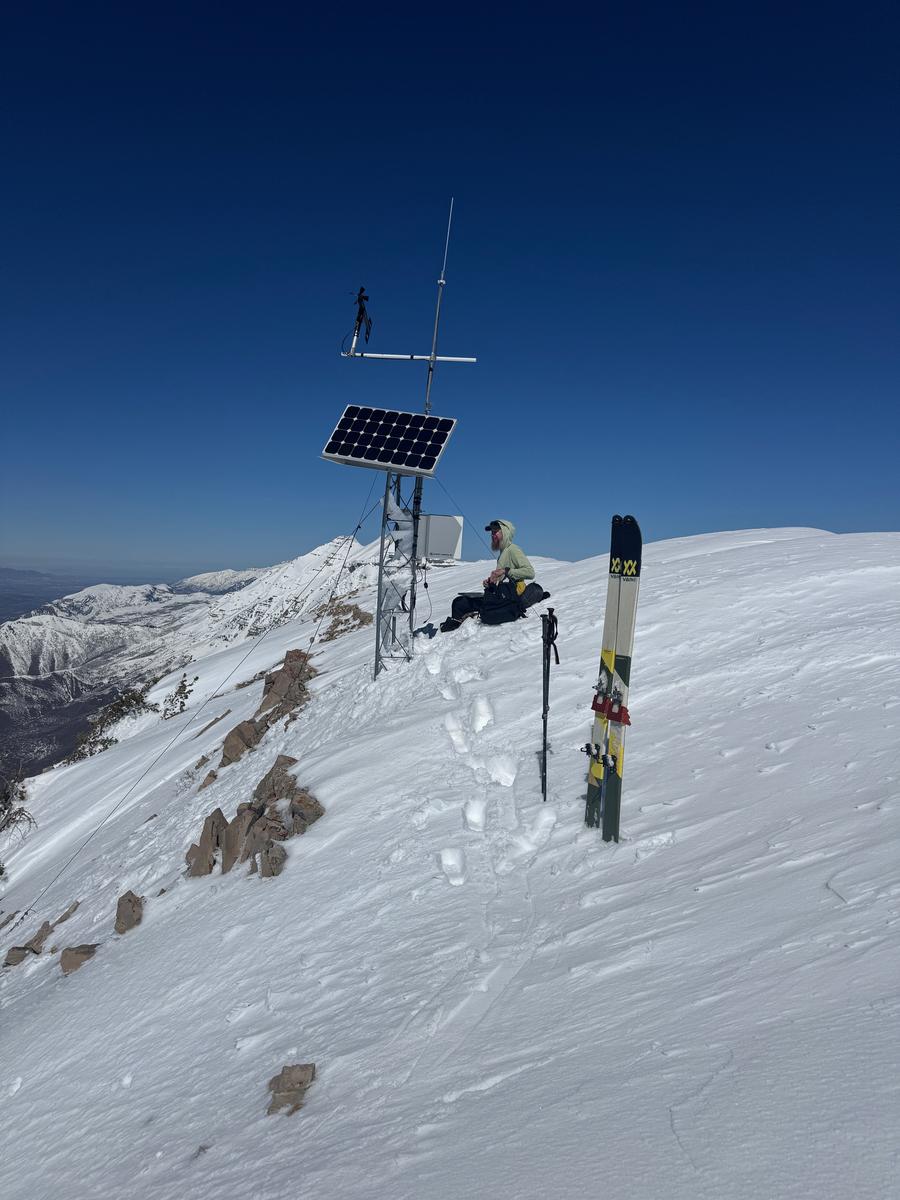
Photo working on Cascade Weather Station
Photo showing the cost of admission


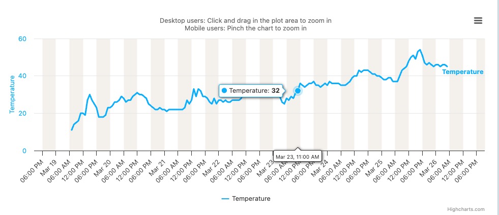
We started the day with a conversation about wind slab potential above treeline, wet slides at all elevations and aspects, and sensitive cornices near the ridgelines. We found wet surface snow and unintentionally triggered one large cornice which proceeded to trigger a persistent weak layer (PWL) avalanche failing in dry snow. Today was a matter of timing and when we ran out of time, we went to very careful route selection and only exposing one person at a time to steeper slopes. Today, started out as a Low danger and rose to Considerable throughout the tour.
Today's Observed Danger Rating
Considerable
Tomorrows Estimated Danger Rating
None
Coordinates


