Observation Date
3/16/2025
Observer Name
Michael Davis
Region
Logan » Southeast Idaho » Moonlight Meadow » Mercham Hollow
Location Name or Route
Copenhagen TH-Moonlight Meadow-Mercham Hollow
Weather
Sky
Overcast
Precipitation
Moderate Snowfall
Wind Direction
Northeast
Wind Speed
Strong
Weather Comments
Throughout the morning and early afternoon as the tail end of the storm moved on we encountered heavy snow, strong winds on the summits (25-35mph), and low visibility By about 1:30pm the sky started to break with some sun but the winds continued to howl throughout the afternoon.
Snow Characteristics
New Snow Depth
8"
New Snow Density
Low
Snow Surface Conditions
Powder
Wind Crust
Melt-Freeze Crust
Damp
Snow Characteristics Comments
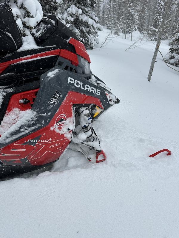
New snow accumulations are anywhere from 6-12" depending on elevation, heavy wind scoured areas and sheltered trees. Deepest being 12" in the higher elevations around wind protected trees. Below the new snow was either a firm sun baked crust or very dense, snow layer depending on aspect (slope direction). To give an idea of the average "new snow" depth i posted a image of my snowmobile ski below.
Red Flags
Red Flags
Heavy Snowfall
Wind Loading
Rapid Warming
Red Flags Comments
High winds and wind transfer snow on all the high elevation peaks and summits, heavy snow, and rapid warming once the sun broke through. Rapid warming was evident by a number of roller balls in the south and west slopes at lower elevations.
Avalanche Problem #1
Problem
Wind Drifted Snow
Trend
Same
Problem #1 Comments
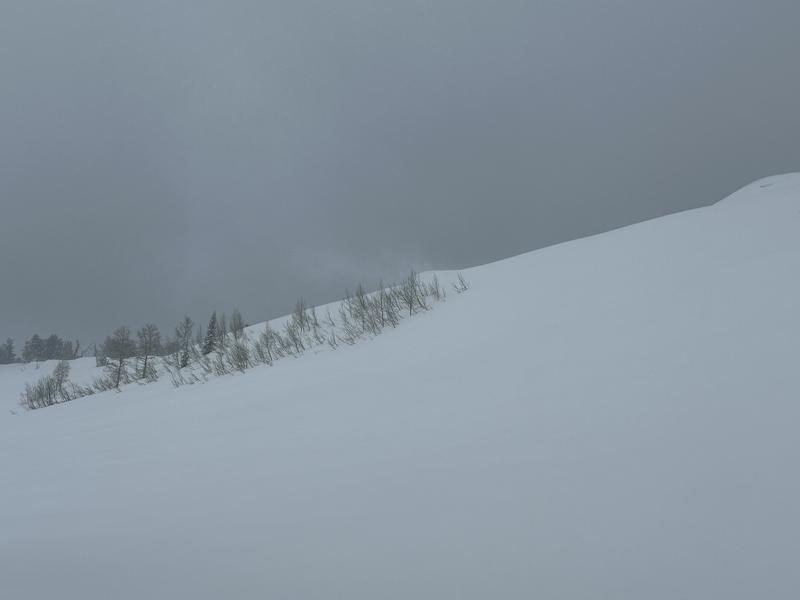
New snow, wind loading, and wind slabs due to the high winds and heavy snowfall throughout the am. See pic below of the active wind/snow transport.
Avalanche Problem #2
Problem
Wet Snow
Trend
Increasing Danger
Problem #2 Comments
As temps climb throughout the day I suspect this could be problematic on sun exposed slopes.
Comments
Overall, the riding conditions at the higher elevations and sheltered terrain was pretty good. In the lower elevations, sun baked aspects and wind scoured areas the riding/turning was more challenging.
Today's Observed Danger Rating
Considerable
Tomorrows Estimated Danger Rating
Considerable
Coordinates