Donate to Our Spring Campaign or Bid on our Spring Auction to Support Forecasting

Observation: Beaver Mountain Backcountry

Observation Date
3/16/2025
Observer Name
Pagnucco, Weed
Region
Logan » Beaver Mountain Backcountry
Location Name or Route
Beaver Mountain Backcountry
Weather
Sky
Broken
Precipitation
Moderate Snowfall
Wind Direction
Southwest
Wind Speed
Strong
Weather Comments
Blustery, with moderate snowfall clearing to broken skies..
Snow Characteristics
New Snow Depth
7"
New Snow Density
Medium
Snow Surface Conditions
Powder
Snow Characteristics Comments
We could feel the crust beneath the recent snow in most areas, so the best conditions were on low-angle slopes with smooth melt-freeze crust below
Red Flags
Red Flags
Wind Loading
Red Flags Comments
Obvious significant wind drifting loading lee slopes and in and around terrain features. We observed building cornices and stiff drifts well over two feet deep. We observed some cracking in drifted snow but did not test any wind slabs on steep slopes./
Avalanche Problem #1
Problem
Wind Drifted Snow
Trend
Increasing Danger
Problem #1 Comments
People could trigger avalanches of wind drifted snow up to 3 feet deep in upper and mid elevation terrain. Large natural and triggered cornice falls are also possible.
Avalanche Problem #2
Problem
Wet Snow
Trend
Increasing Danger
Problem #2 Comments
We didn't stick around long enough to see when the strong sun and warm temps would cause the new snow to get sticky of moist enough to elevate the danger of wet avalanches, but that likely happened in some places this afternoon despite the cooling winds.
Comments
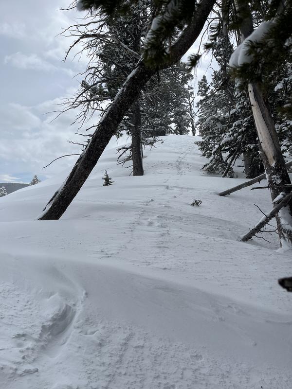
Drifting of the new snow by strong and gusty winds from the southwest was significant in all terrain in the Logan Canyon Area.
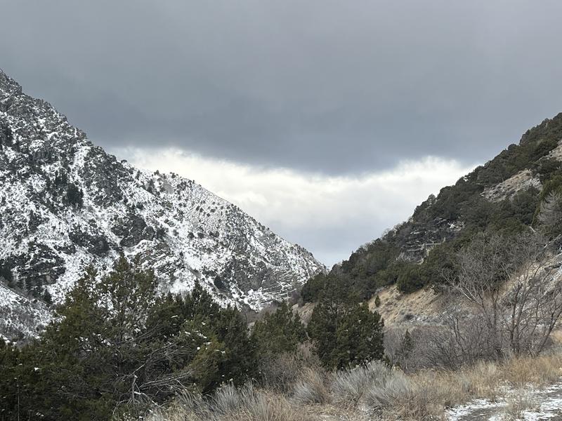
I caught a neat view of the frontal clouds coming into the mouth of Logan Canyon this morning.
Today's Observed Danger Rating
Considerable
Tomorrows Estimated Danger Rating
Considerable
Coordinates