UDOT PLANNED AVALANCHE CLOSURES!!

Observation: Cardiff Pass

Observation Date
3/4/2025
Observer Name
Malone and AAI Pro 1
Region
Salt Lake » Little Cottonwood Canyon » Cardiff Pass
Location Name or Route
Cardiff flats
Weather
Sky
Overcast
Wind Speed
Light
Weather Comments
We noted graupel early in the day, a change from the low density stellars that fell yesterday afternoon.
Snow Characteristics
New Snow Depth
16"
New Snow Density
Medium
Snow Surface Conditions
Powder
Dense Loose
Snow Characteristics Comments
The snow felt mildly upside down from the higher density snow falling later in the storm, but still skied well where it was smooth underneath. We could still easily feel the melt freeze crust underneath the new snow on solars.
Red Flags
Red Flags
Recent Avalanches
Heavy Snowfall
Wind Loading
Cracking
Poor Snowpack Structure
Red Flags Comments
Cracking was localized to ski tips stepping off the skin track. We observed two small soft slab avalanches on SE aspects b/t 9800' and 9600', one natural and one intentionally skier triggered. Both appeared to be new snow running on the old MF surface. SS-N-R1/D1-O, SS-AS-R1/D1-O
Avalanche Problem #1
Problem
Persistent Weak Layer
Trend
Same
Problem #1 Comments
We found a thin layer of near surface facets under a decomposing melt freeze crust on upper elevation N and had full propagation on two ECTs in two pits, as well as multiple easy CT failures with sudden fracture quality. This avalanche problem was not my primary concern this morning, but it is now, and will affect our decisions in north facing terrain these next few days with more snow in the forecast. The trend will remain the same overnight but I expect it to increase with the arrival of our next system tomorrow afternoon/ evening.
We had easy failure within the new snow with the top 20 cm of graupel failing on top of the 20 cm of stellars (see pics) but this had little cohesion (BKN, Q3) and should settle out quickly.
Avalanche Problem #2
Problem
Wind Drifted Snow
Trend
Same
Problem #2 Comments
We noted active transport of snow by the W-NW winds today.
Snow Profile
Aspect
North
Elevation
9,700'
Slope Angle
18°
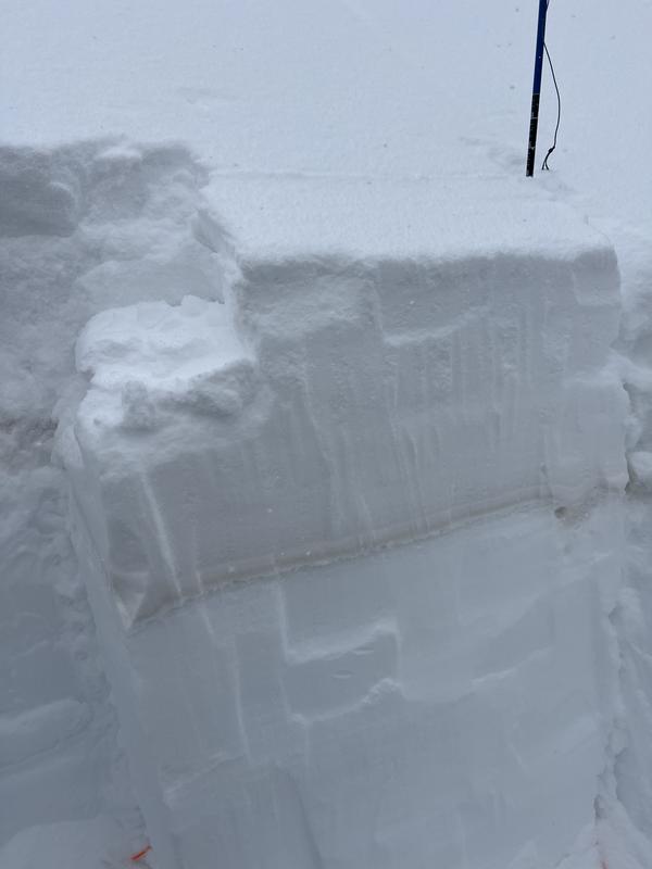
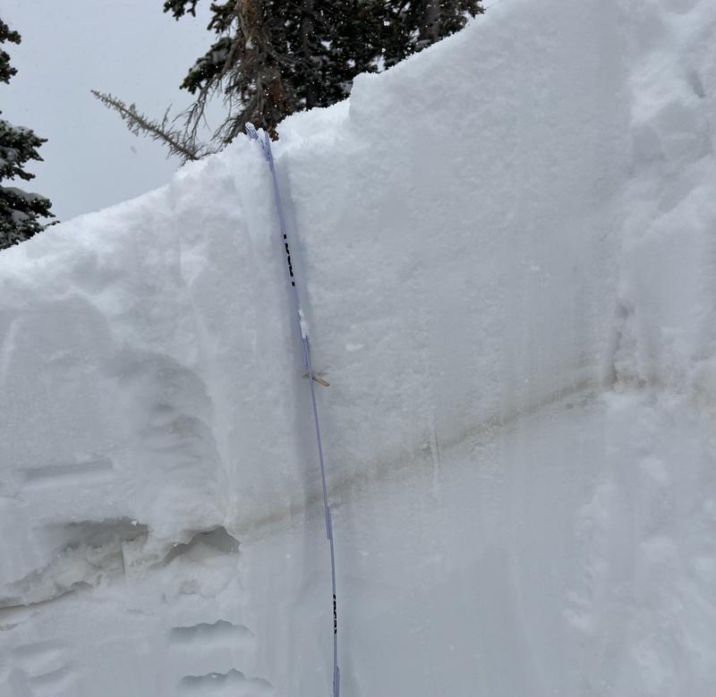
This seems to be an unusually complex Wasatch snowpack for March, now with the addition of near surface facets to the list of factors complicating (or just narrowing) terrain choices, including repeater slopes, Feb 1 facets, and November facets. At least more snow is in the forecast to keep the low angle skiing fresh and fun.
Today's Observed Danger Rating
Considerable
Tomorrows Estimated Danger Rating
Considerable
Snow Pilot URL