
Observation Date
2/22/2025
Observer Name
Kelly, Worthen
Region
Salt Lake » Stansbury Range
Location Name or Route
Stansbury Range
Comments
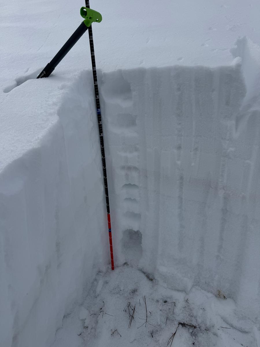
Snowpits showed total depth around 3'-4' depending on location and elevation. Some north-east facing slopes were less than 2' deep and made up of mostly faceted snow. In the above pit which did have a slab of 1F and 4F snow above the facets, we were able to get results with compression tests in the teens. In other snow pits on north-east facing slopes with less snow we were getting failure with isolation on a crust/facet combination near the ground.
Photo below of mature depth hoar on a north facing slope at 9,000' in elevation.
Photo below of mature depth hoar on a north facing slope at 9,000' in elevation.
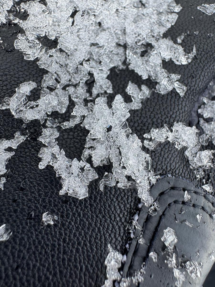
Photo of a series of avalanches on an east-southeast facing slope at 10,500'. Some ran on facets near the ground and the lower right slide ran more recently (perhaps today) on a dirt layer. 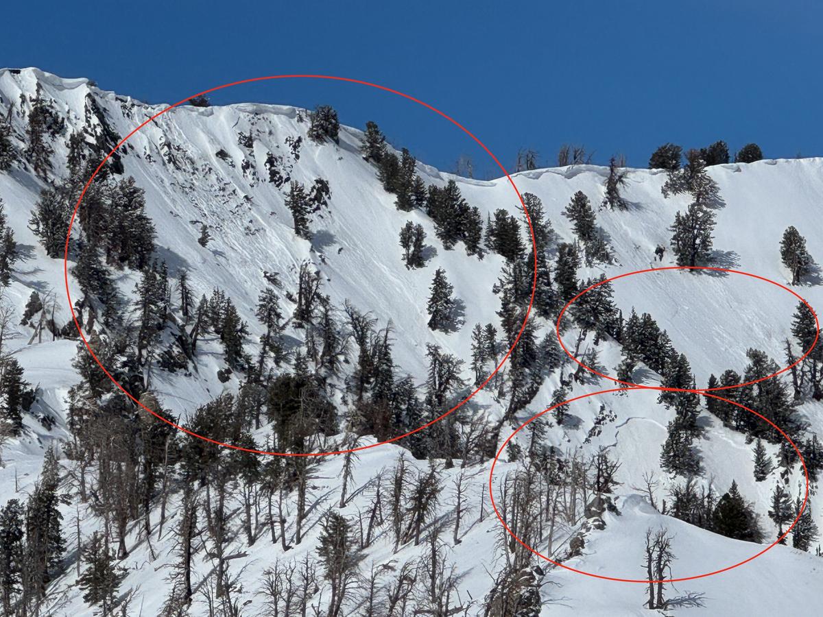
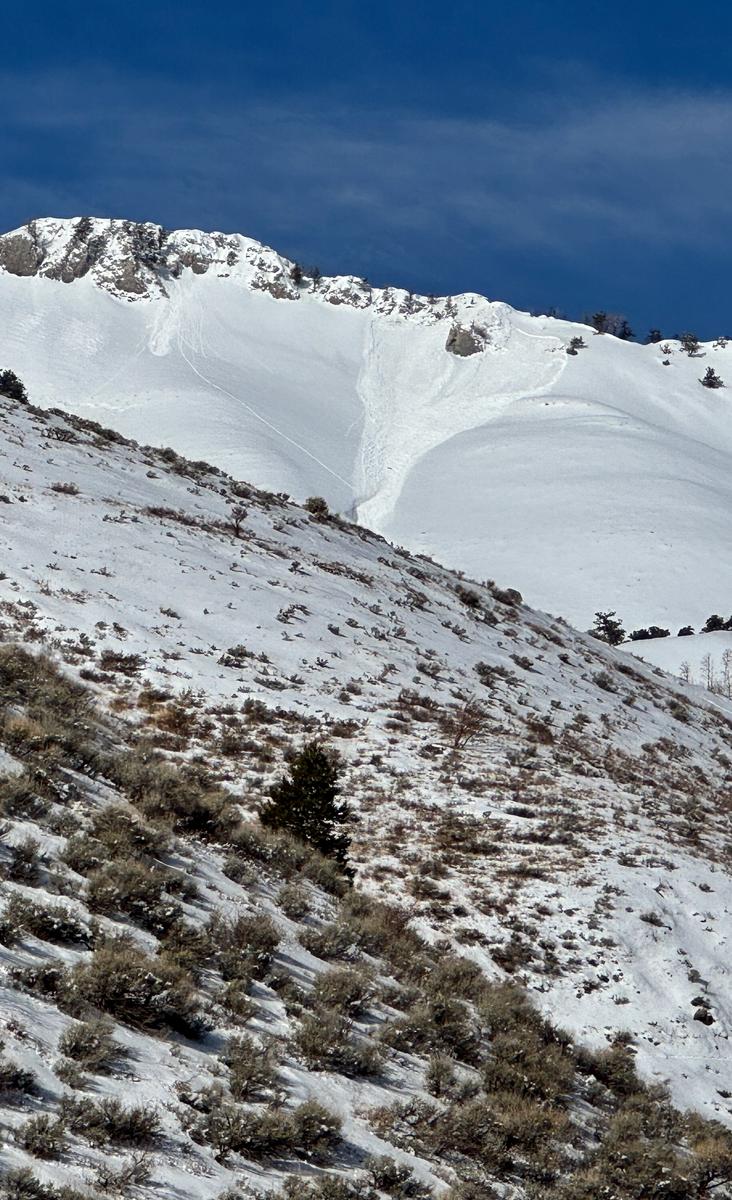
Below photo of an avalanche on an east facing slope at 9,800' in elevation.
Today's Observed Danger Rating
None
Tomorrows Estimated Danger Rating
None
Coordinates


