Observation: Silver Fork

Observation Date
2/19/2025
Observer Name
Malone, Morgan
Region
Salt Lake » Big Cottonwood Canyon » Silver Fork
Location Name or Route
Silverfork
Weather
Sky
Few
Wind Speed
Calm
Weather Comments
The morning started cold and clear; by midday it was warm and overcast.
Snow Characteristics
New Snow Depth
6"
New Snow Density
Medium
Snow Surface Conditions
Powder
Dense Loose
Faceted Loose
Snow Characteristics Comments
Low density stellars were visible on all aspects early in the day. The new snow settled with the warming mid morning and skied well, with some green-housing midday.
Red Flags
Red Flags
Recent Avalanches
Heavy Snowfall
Wind Loading
Rapid Warming
Poor Snowpack Structure
Red Flags Comments
We observed multiple small natural avalanches in steep terrain in east facing Days Fork, on the far skier's left of Banana Days and Crystal Palace. Pics 1, 2.
Avalanche Problem #1
Problem
Persistent Weak Layer
Problem #1 Comments
A hasty pit at 9700' on an ENE slope showed that the upper meter of the snowpack was mostly right side up, the exception being NSF about 45 cm down (likely formed during our high pressure Feb 9-10) identified on an easy shovel shear but without any propagation on an ECT. Deeper than our two most recent storms, things appear significantly more complicated. Large grain graupel from the Feb 7th storm was 90 cm deep at this location (and fell out of the wall of the pit, pic 3, 4), and small grained facets buried on Feb 1 were 105 cm down and easy to find. We had no propagation but given the spatial variability and the variety of test results throughout the Wasatch the past few days, our ECTX didn't really bring me any comfort.
Comments
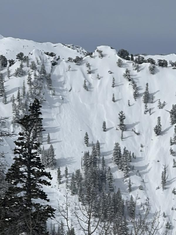
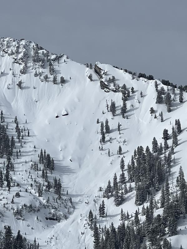
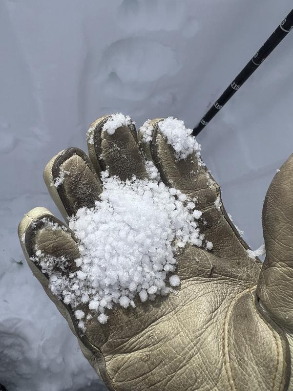
We currently have multiple PWLs in the snowpack, and natural and skier triggered avalanches failing 1 to 4' deep on a crust facet combo on solars, or facets buried Feb 1, Feb 7, or Feb 12. We can easily see and track the recent storms, the (perhaps record?) large grain graupel, the dust, the warm and windy week of early Feb, the rain, and the early season drought-causing facets throughout the pack. Our stability tests are consistently unreliable in predicting the sensitivity of PWLs. As these suspect layers get buried, they will become more difficult to trigger, and more difficult to predict.
It's great to be back in the flow with more consistent snowfall these past two weeks, and hopefully today's warming will help the new snow bond to the surface tomorrow. But the persistent weak layers persist.
Today's Observed Danger Rating
Considerable
Tomorrows Estimated Danger Rating
Considerable
Coordinates