Observation Date
2/16/2025
Observer Name
Ryan Huels
Region
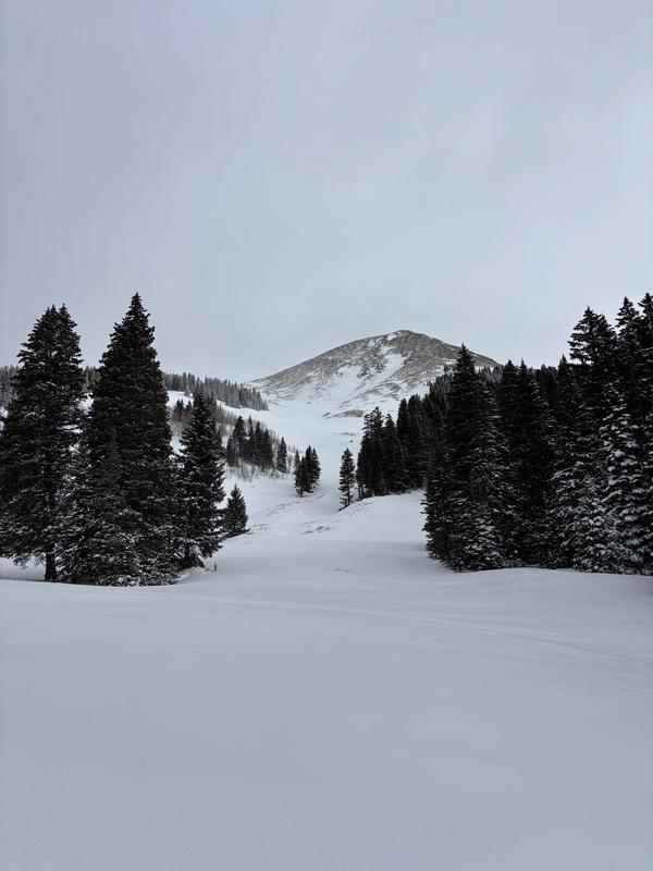
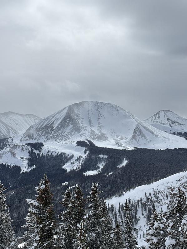
Moab » Manns Peak
Location Name or Route
Mann’s Peak
Weather
Sky
Overcast
Wind Speed
Moderate
Weather Comments
The morning was partly cloudy with light winds from the SW. Throughout the day cloud cover increased to overcast and winds increased to moderate speeds out of the SW. Snow transport was evident onto leeward slopes. By afternoon I observed light snow to the South in the Mt. Peal Basin. Chance of snow tomorrow/tomorrow night with increasing winds out of the SW.
Snow Characteristics
New Snow Depth
12"
New Snow Density
High
Snow Surface Conditions
Powder
Snow Characteristics Comments
Around a foot of new snow was present in Tomasaki/Manns basin with higher amounts as I went up in elevation. New snow was dense, fast, "surfy" and provided fun skiing/riding. The best of the season so far. Throughout the day as winds increased the top layer became slightly more stiff.
Red Flags
Red Flags
Wind Loading
Cracking
Collapsing
Poor Snowpack Structure
Red Flags Comments
I did not observe any avalanches in my travels but I noted lots of wumpfing, mostly isolated to areas shaded by trees on elevations in the 10500-11200 range. The majority of my travels were in flat meadows and on SW facing terrain. I did not notice as much wumpfing on open areas with more solar gain. There was some isolated cracking, but no shooting cracks. I did not travel on slopes greater than 30 degrees.
Avalanche Problem #1
Problem
New Snow
Trend
Same
Problem #1 Comments
The new snow has created a load on top of our already weak snowpack. In addition this new snow has been moved around by the wind. I was initially concerned for instability at the new snow/old snow interface but I was able to produce instability results on my ECT into old weak layers, see below. Chances of snow throughout the week in addition to wind could possibly add to our new load.
Avalanche Problem #2
Problem
Persistent Weak Layer
Trend
Same
Problem #2 Comments
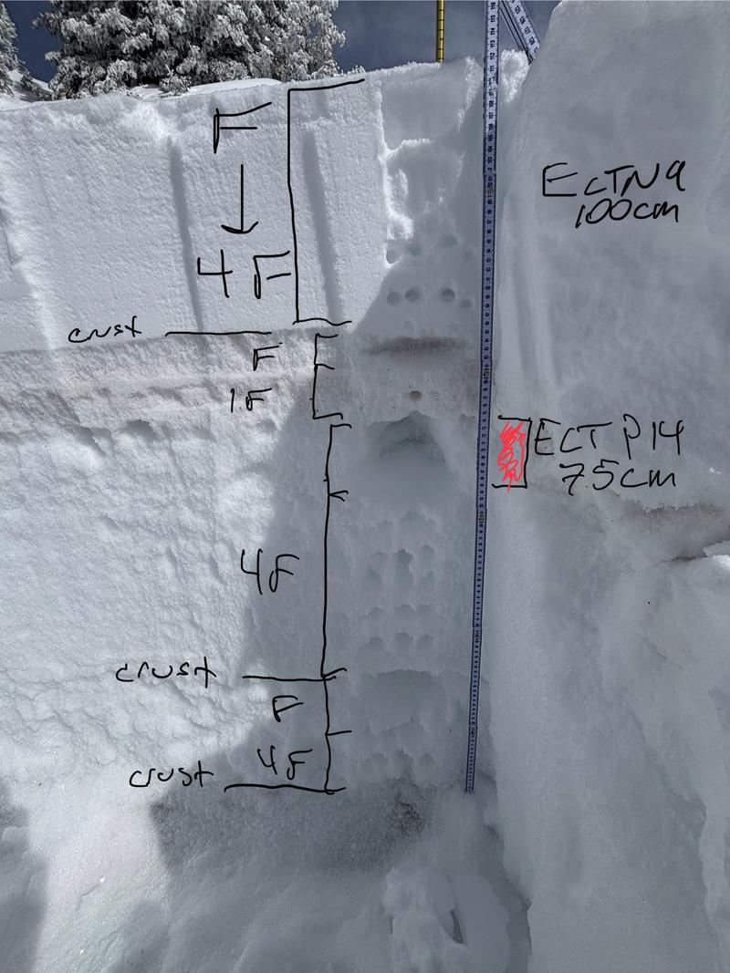
Poor snowpack structure with multiple week layers in between dense slabs and crusts. The new snow we received is very dense and put a heavy load on our already weak snowpack. Potential for avalanches at the new snow/old snow interface with the possibility of them stepping down into old weak layers with the right load on the right terrain. ECTP 14 at 62cm is keeping me away from >30.
Snow Profile
Aspect
Southwest
Elevation
11,700'
Slope Angle
22°
Comments
Pit dug at 11750' on SW aspect. Total snow depth was 113cm. Multiple week layers and stiff crusts throughout. I did an extended column test with results of ECTN9 @ 100cm and ECTP14 @ 75cm on a layer of faceted snow.
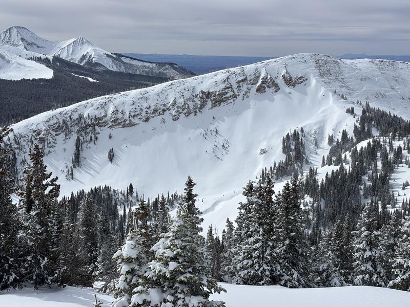
Tomasaki WSW slide path with limited snow above tree line and filled in at the bottom and a steep northerly facing slope that has been loaded by new snow and wind transport. No evidence of avalanches, but this is a slope I am avoiding being on or below.
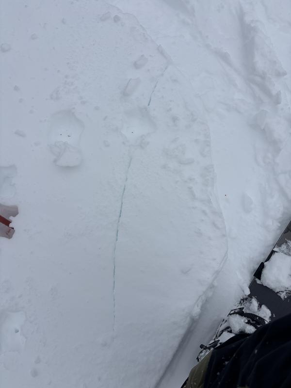
Wind transport onto N-NE-E facing terrain in the afternoon, and isolated cracking on SW facing terrain below treeline
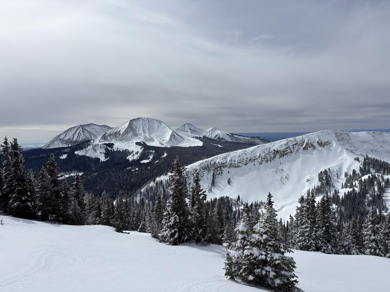
Our beautiful mountains looking and skiing much better after the snow
Today's Observed Danger Rating
Considerable
Tomorrows Estimated Danger Rating
Considerable
Snow Pilot URL