Observation Date
2/8/2025
Observer Name
Magerl
Region
Skyline » Huntington Canyon » Electric Lake
Location Name or Route
Electric Lake
Weather
Sky
Clear
Wind Direction
West
Wind Speed
Light
Weather Comments
If last week was April weather, this morning was mid-March, but by the end of the day, February was clawing its way back in. Sunny, mostly still and warm at 10 A.M. Temperature at 9,180 feet at 11:30 A.M. was 28 degrees. By 2:30 P.M. the clouds had moved in, the wind from the west increased to moderate, and it was easy to see much snow transport.
Snow Characteristics
New Snow Depth
6"
New Snow Density
Low
Snow Surface Conditions
Powder
Snow Characteristics Comments
Light fluff at 10 A.M. in the 8,600 foot to 9,200 foot range. By 11 A.M. the east-facing was already showing signs of sun damage. There is a slick crust on the east-facing that was mercifully supportable. No sloughing, but we skied nothing steeper than 25 degrees. The exit on the north-facing had not quite as stout a crust and it was possible to break through on some turns. Moving onto anything with the slightest of southeast facing after noon made for a bit of struggle to make turns. The snow became heavy. Would expect everything southeast, south and southwest to have a crust tomorrow. The east and north were fine. Did not hit any west, but the heavy cloud cover that rolled in by 2p might have spared the west-facing.
Red Flags
Red Flags
Poor Snowpack Structure
Red Flags Comments
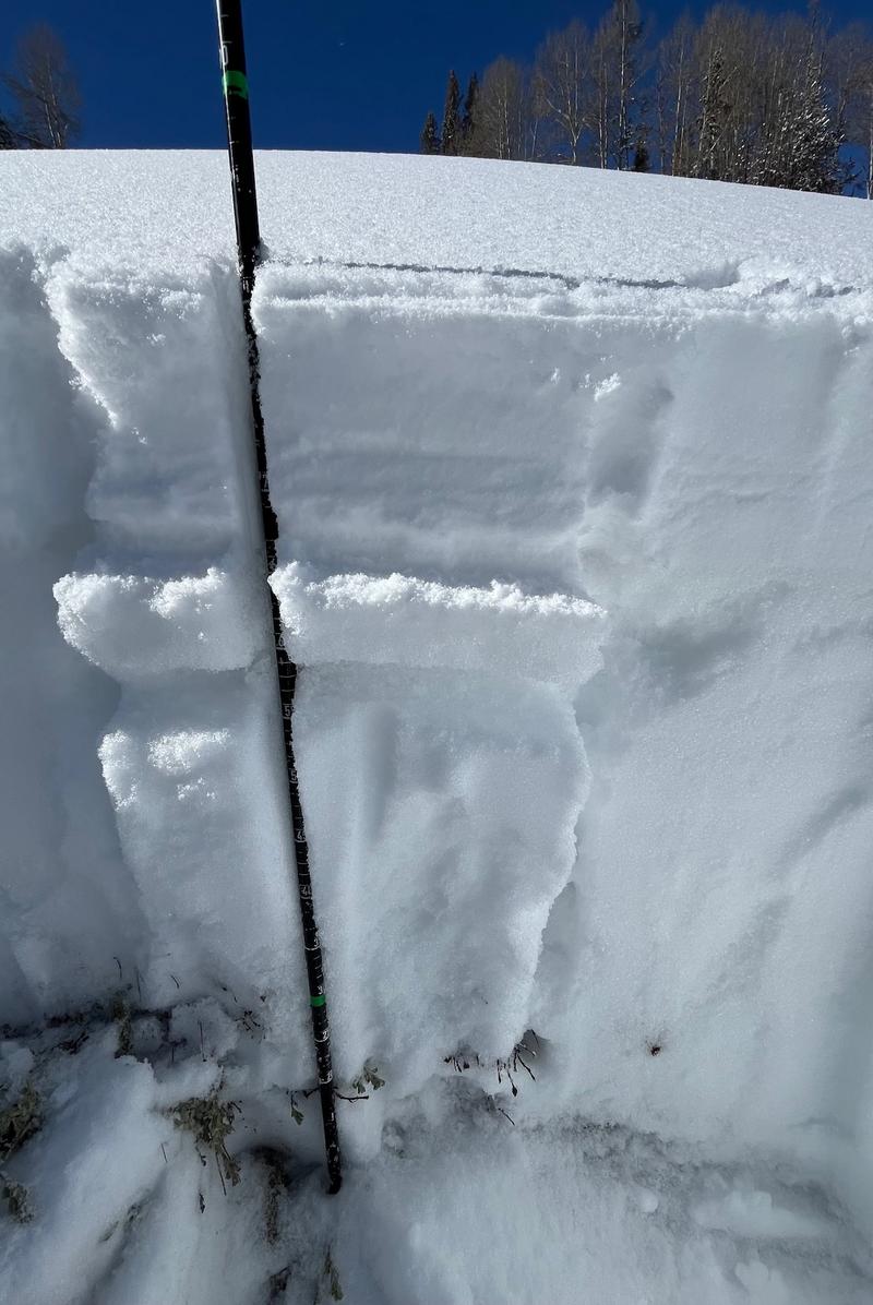
Dug a pit on east-facing 30 degree at 8,700 feet. Total depth 80 cm. Top 15 cm was light powder, then a 5cm slick, thick crust. Below that, 60cm of wet loose grains to the ground. ECT 12, but it broke in the top 20 cm only, with not much energy and did not move the deep pile of loose grains. Absolute boot penetration to the ground. Poles on the skin track were happy to sink all the way in.
Nothing much reactive today. No cracks, no collapsing. Still plenty of weak snow at the base, in this case 60 cm of the total 80 cm. If a thumper comes in as forecast next Thursday night, I would expect a lot of areas to just be waiting for a trigger.
Today's Observed Danger Rating
Moderate
Tomorrows Estimated Danger Rating
Moderate