Join us at our 2nd Annual Blizzard Ball

Observation: Grizzly Gulch

Observation Date
1/13/2025
Observer Name
Champion & Whitefields
Region
Salt Lake » Little Cottonwood Canyon » Grizzly Gulch
Location Name or Route
East Bowl Pass - Michigan City
Weather
Sky
Broken
Precipitation
Light Snowfall
Wind Direction
Northwest
Wind Speed
Moderate
Weather Comments
It was a later start to the day. By the time we were heading up the canyon, the clouds were building, and visibility was rapidly decreasing. Temperatures were very cold, in the teens. Light precipitation persisted throughout the afternoon, with an accumulation of about 1-2 inches. Winds were light within the trees and moderate along the ridgelines.
Snow Characteristics
New Snow Depth
2"
New Snow Density
Low
Snow Surface Conditions
Powder
Snow Characteristics Comments
The weekend's soft, low-density snow made for great travel and fun riding. On true solar aspects, a bit of crust lingered beneath this afternoon’s few inches of fresh snow, but it wasn’t very noticeable if the slope tilted even slightly away from the sun. On southerly slopes, you could still feel the older bottom crust at times, but on north and east-facing slopes, the crust was undetectable beneath the newest snow.
Soft snow still sitting on trees near 9800' of Grizzly Gulch
Red Flags
Red Flags
Poor Snowpack Structure
Red Flags Comments
We didn’t observe any cracking or collapsing during our travels, but we did find a very poor snowpack structure on upper-elevation west-facing terrain at the top of East Bowl.
Avalanche Problem #1
Problem
Persistent Weak Layer
Trend
Decreasing Danger
Problem #1 Comments
We’re starting to narrow down the persistent weak layer. Right now, the Wasatch snowpack is showing a tale of two conditions. The very poor snowpack structure remains, especially in suspect areas like mid-elevations, shallower zones along the Park City ridgeline, Big Cottonwood Canyon, and any slope that’s a repeater.
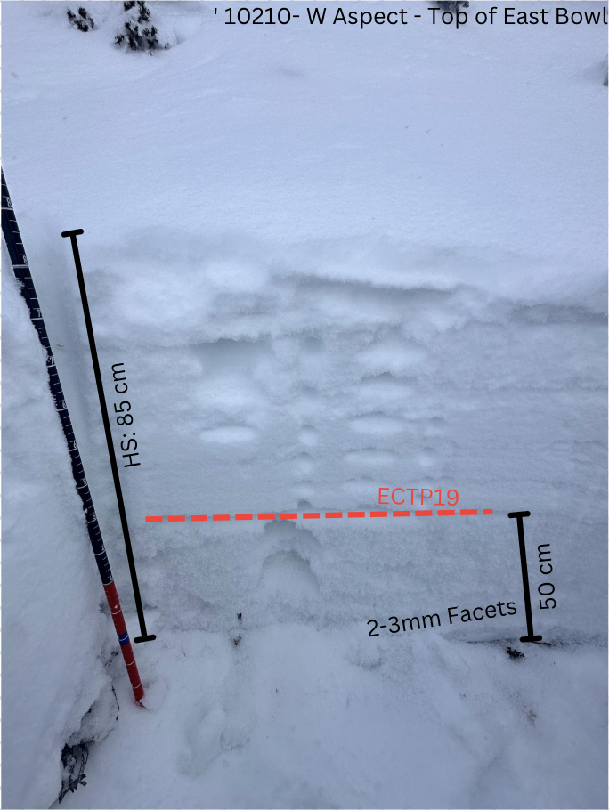
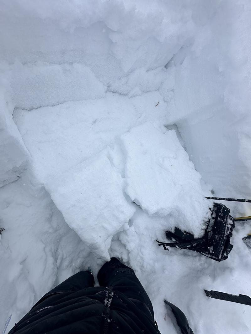
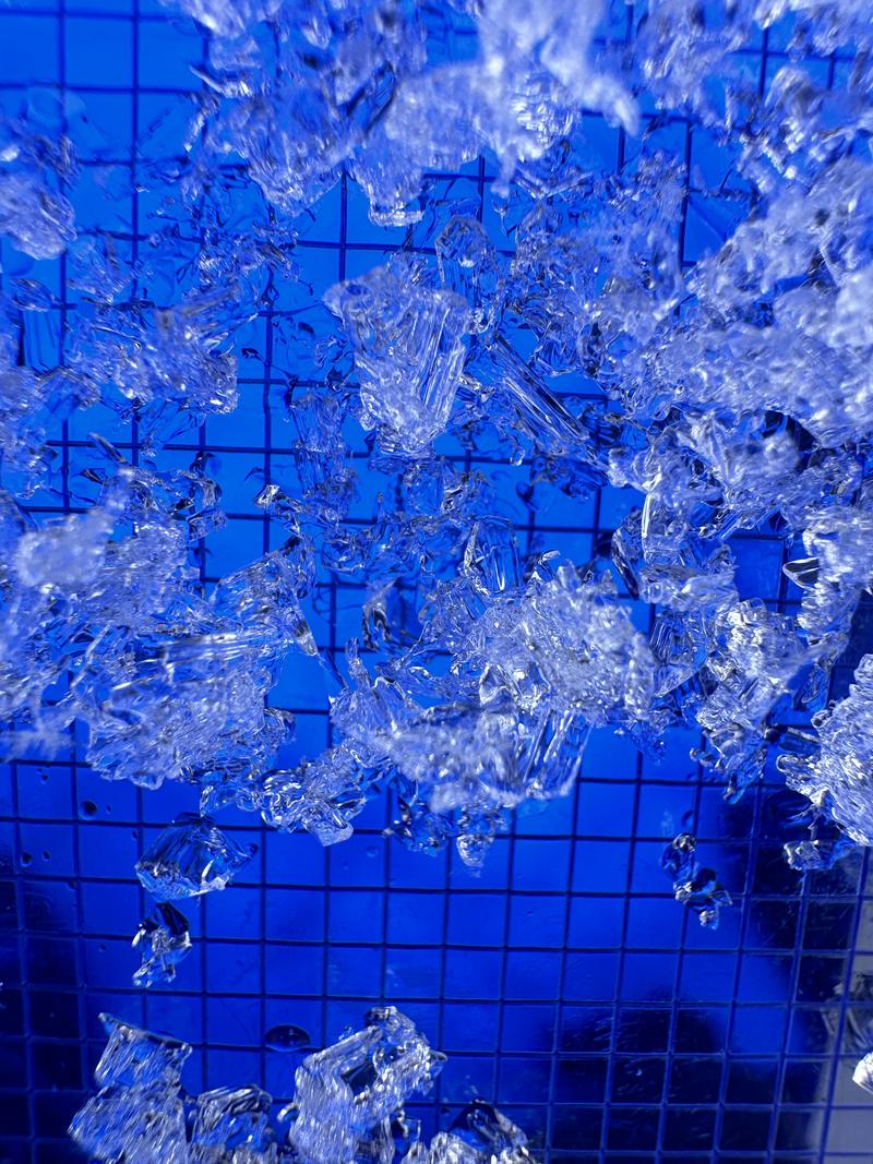
In contrast, the Upper Cottonwoods have received significantly more snow and insulation, and many areas are trending toward stabilization. However, we dug a pit near the top of East Bowl on a true west aspect at 10,180' and found a surprisingly weak, shallow snowpack. This slope, which had no obvious ski tracks, is a repeater and serves as an indicator for some of the most suspect terrain. Near the ground, we found approximately 40 cm of well-developed, cupping facets. In our snowpit we got an ECTP19 down on the facets.
While I don’t think this weak structure is widespread across all west-facing aspects, it’s a red flag for upper-elevation west-facing slopes that may have previously avalanched or are holding weaker, shallower snowpacks. The challenge is distinguishing zones with deeper, healing snowpack from those with these isolated weaker pockets. I wouldn't drop into East Bowl today.
Avalanche Problem #2
Problem
Wind Drifted Snow
Trend
Increasing Danger
Problem #2 Comments
Surprised by the occasional moderate gusts, there’s a significant amount of soft snow available for transport on nearly all aspects. With the increase in overnight winds, it wouldn’t take much for snow to move and drift, particularly at mid and upper elevations.
Snow Profile
Aspect
West
Elevation
10,200'
Slope Angle
35°
Comments
Photo of the snowpit profile near the top of East Bowl proper on a west facing aspect - 10210'
The results of the ECTP19 down 50cm on the facets - West Aspect - 10210'
The large facets and even cupping grains at the bottom - West Aspect - 10210'
Today's Observed Danger Rating
Moderate
Tomorrows Estimated Danger Rating
Moderate
Coordinates
Snow Pilot URL