Join us at our 2nd Annual Blizzard Ball

Observation: Empire Pass

Observation Date
1/4/2025
Observer Name
Zimmerman-Wall/Brown
Region
Salt Lake » Park City Ridgeline » Empire Pass
Location Name or Route
Empire Pass
Weather
Sky
Obscured
Precipitation
Moderate Snowfall
Wind Direction
Northwest
Wind Speed
Moderate
Weather Comments
Arrived at 0930 to S1 snowfall and steady moderate NW winds. The temps fell through the day and squalls came through continuously throughout the afternoon until our departure at 1600. Winds never relaxed and some transient sunshine gave the mountains an etherial glow. A brief pause in the action around 12 gave way to some views of Claytons and Jupiter, but only briefly before back into the snow globe.
Snow Characteristics
New Snow Depth
4"
New Snow Density
Low
Snow Surface Conditions
Powder
Snow Characteristics Comments
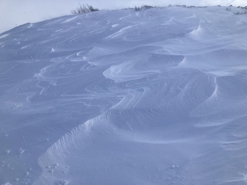
Hard to discern exact totals with the continuous wind, but drifts grew up to 10-12" deep quite quickly.
Red Flags
Red Flags
Recent Avalanches
Heavy Snowfall
Wind Loading
Cracking
Collapsing
Poor Snowpack Structure
Red Flags Comments
Hard to miss them today. New snow had layered hardness changes and was quite reactive to provocation.
Avalanche Problem #1
Problem
Wind Drifted Snow
Trend
Increasing Danger
Problem #1 Comments
This was the most prolific problem in our chosen zones which primarily faced S-SE.
Avalanche Problem #2
Problem
Persistent Weak Layer
Trend
Same
Problem #2 Comments
Did not investigate with formal tests, but lots of probing and stomping about out of skis, you could easily assess the structure of strong over weak. Although HS averaged 75-100cm in our area, some faceted snow was on the ground. These facet layers were not nearly as thick as on the Little Cottonwood side of things.
Comments
Video of cracking and mini cornice breaking out ahead of skin track on small test slope
Photo of surface texture on a broad ridge feature around Empire pass. Wind Which Way?
Video
Today's Observed Danger Rating
High
Tomorrows Estimated Danger Rating
None
Coordinates