AVALANCHE WARNING!! Tap for info

Observation: Wolf Creek

Observation Date
12/26/2024
Observer Name
Torrey & Davis
Region
Uintas » Wolf Creek
Location Name or Route
Wolf Creek Pass
Weather
Sky
Broken
Precipitation
Light Snowfall
Wind Direction
West
Wind Speed
Moderate
Weather Comments
The weather gradually cleared out early in the morning, with a break midday, before clouds, snow, and wind returned about 3:30 p.m.
Snow Characteristics
New Snow Depth
2"
New Snow Density
Low
Snow Surface Conditions
Powder
Snow Characteristics Comments
Sandbox skiing on steep slopes became more supportable on lower-angle slopes but still variable.
Red Flags
Red Flags
Wind Loading
Cracking
Collapsing
Poor Snowpack Structure
Red Flags Comments
Collapsing on small test slopes. One larger collapse across a terrain feature near the end of the day on a slope with active wind drifting.
Avalanche Problem #1
Problem
Persistent Weak Layer
Trend
Increasing Danger
Problem #1 Comments
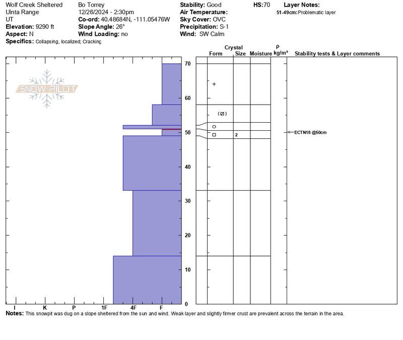
A soft, fragile crust was consistently observed directly above the December facet layer in the area. While this crust was weak, it was more cohesive compared to the underlying faceted weak layer. Sheltered slopes showed 2-3 inches of new snow atop a mid-pack almost entirely composed of faceted grains with minimal strength or structure.
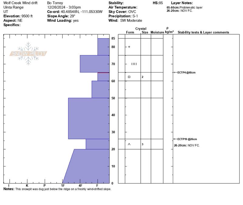
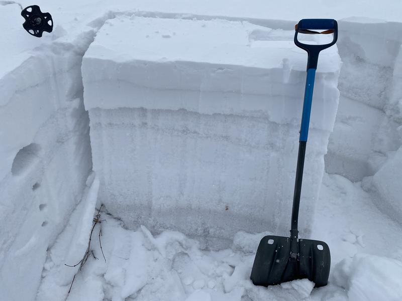
In contrast, slopes near ridgelines, where wind drifting commonly occurs, had a more robust and layered snowpack. Both the December and November facet layers were clearly identifiable and reactive in extended column tests, propagating fractures. These findings suggest a potential for step-down avalanches, particularly on mid and upper-elevation slopes where old dense wind-drifted slabs preserved the mid-pack structure during December's dry period. Regardless, the snowpack is very weak.
Today's Observed Danger Rating
Moderate
Tomorrows Estimated Danger Rating
Considerable
Coordinates