Observation Date
12/1/2024
Observer Name
Tim Matthews, Trenbeath, and Benson.
Region
Moab » Laurel Highway
Location Name or Route
Laurel Highway, Upper NW Funnel, and Goldminers into Gold Basin
Weather
Sky
Clear
Wind Direction
Northwest
Wind Speed
Calm
Weather Comments
Another clear and calm day, with only the lightest breeze felt at about 11,700 feet. Temps peaked at 39 degrees in Gold Basin at 13:00.
Snow Characteristics
Snow Surface Conditions
Powder
Faceted Loose
Wind Crust
Damp
Snow Characteristics Comments
All sorts of snow surfaces out there today. Polar aspects holding cold dry powder with the most recent top 6" of medium density snow losing strength, and becoming near surface facets. The surface snow will continue to weaken under our current high pressure. This will be something to pay attention to once it get's buried. Still quite supportable with skis on, but foot pen is now nearly to the ground on N, NE, and E aspects.The solar aspects took on some heat today. With little to no wind to help cool the surface snow, with above freezing temps snow surfaces became damp, and will crust over this evening.
Red Flags
Red Flags
Rapid Warming
Poor Snowpack Structure
Red Flags Comments
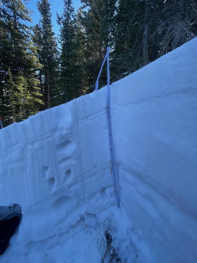
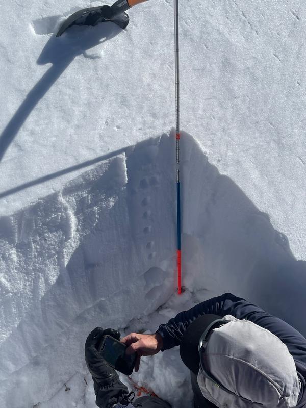
The snowpack structure remains poor. We looked at snow on a NE and NW aspect and found strong over weak. I'd expect to find similarly poor structure on East facing slopes. While SE near and above treeline remain suspect. Rapid warming in terrain below treeline. Gold Basin showed a 22 degree temperature swing in a 12 hour period from 01:00 to 13:00 where temps reached 39 degrees F. The solar aspects became damp, but did not show signs of rollerballs, or wet loose avalanches.
Avalanche Problem #1
Problem
Persistent Weak Layer
Trend
Decreasing Danger
Problem #1 Comments
The snowpack has now had some time to adjust to the major loading event from 11/26-27th, and thus showing fewer obvious red flags such as cracking and collapsing. We traveled over quite a bit of terrain today, and didn't experience any cracking or collapsing. Where on my last tour from 11/28 it was everywhere you stepped out of a track. Here's the thing though folks. The structure is still poor with strong over weak, and we continue to see propagating results in ECT's. As the likelihood of triggering one of these avalanches decreases please remember that the consequences remain very real.
Avalanche Problem #2
Problem
Wind Drifted Snow
Trend
Decreasing Danger
Problem #2 Comments
I think we will see this problem go away until the winds come back in ernest as there is still snow available out there for transport.
Snow Profile
Aspect
Northeast
Elevation
11,000'
Slope Angle
24°
Comments
Structure remains poor, but with fewer red flag signs of instability. ECT's continue to fail in the moderate range, and I've been taught to not trust facets, so I will continue to keep my guard up and my slope angles down.
Video
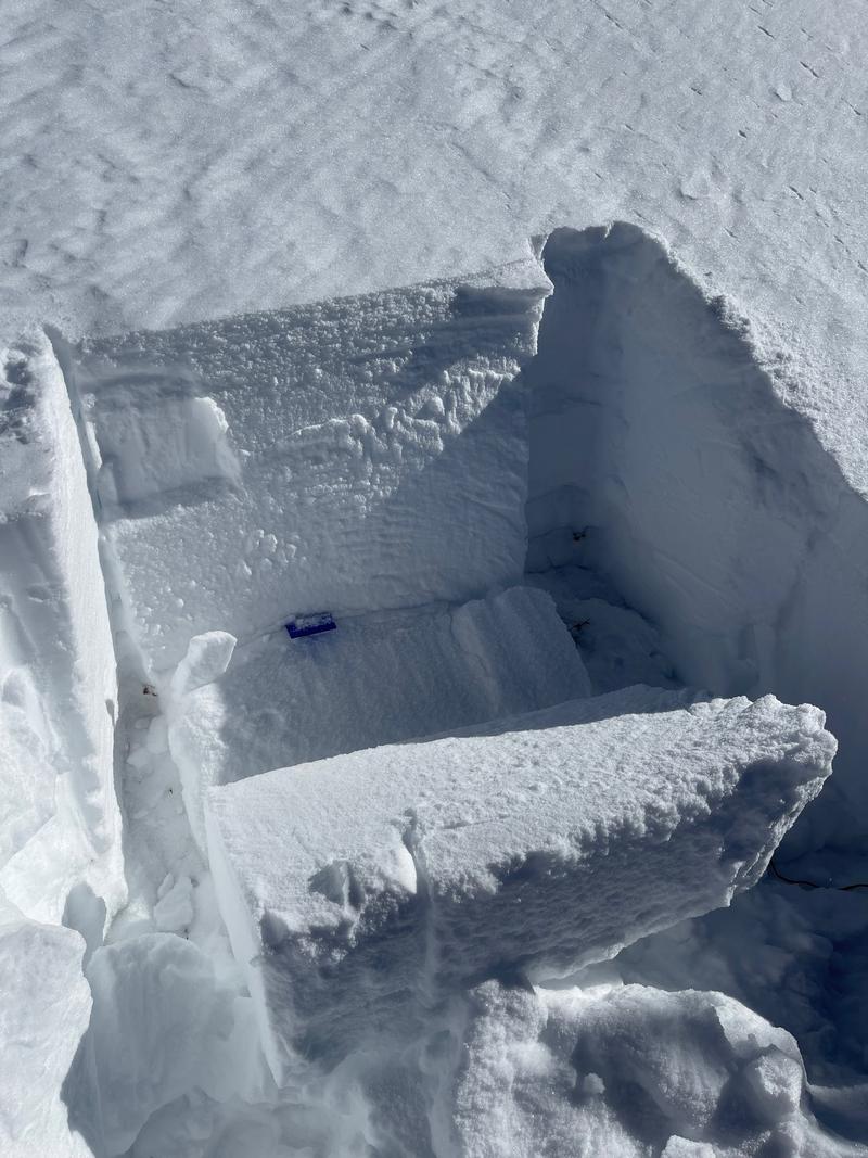
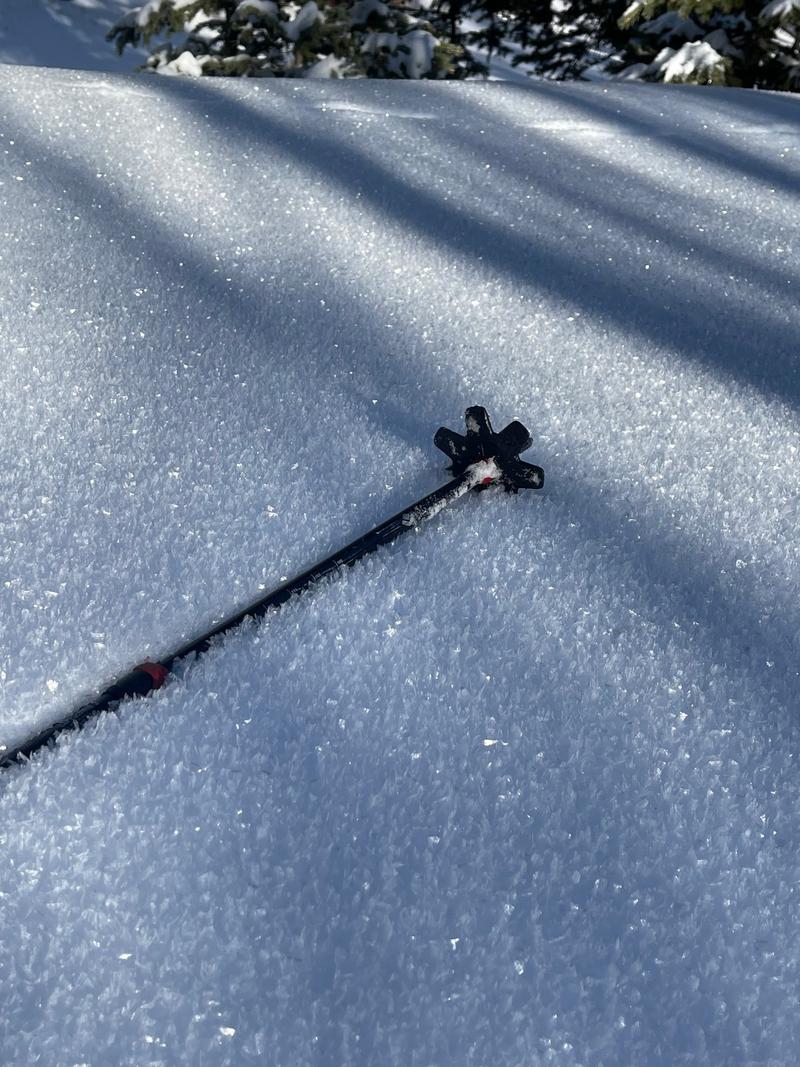
1st pic and video highlighting the poor snowpack structure found on Julie's Backside NE 11,015 feet, The 2nd picture highlighting the poor structure we found on a NW aspect at 11,260 feet. The height of snow at this pit was 100cm and the slab was much firmer than on Julie's Backside due to the influence of wind. 3rd picture is the 1 finger slab that pulled out from an ECTP 15. 4th picture highlighting the surface hoar formation found below treeline from the past few cold, clear, and calm nights.
Today's Observed Danger Rating
Considerable
Tomorrows Estimated Danger Rating
Moderate
Coordinates


