Observation Date
11/27/2024
Observer Name
Nassetta, Torrey
Region
Uintas » Wolf Creek
Location Name or Route
Wolf Creek Pass
Weather
Weather Comments
Skies stayed covered, until about 1000 when they went broken, and ultimately went scattered later in the afternoon. Temps felt cool in the teens, and a light breeze was moving from the NW.
Snow Characteristics
Snow Characteristics Comments
We received an additional 6-12" last night and and it was capped in the last few hours of the storm by some light-density snow. Skiing conditions were fantastic where the snowpack has supportable structure in protected terrain and out of the windzone.
Red Flags
Red Flags
Wind Loading
Cracking
Collapsing
Poor Snowpack Structure
Red Flags Comments
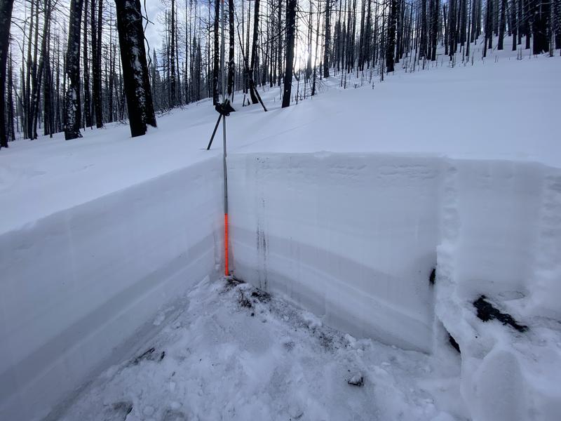
Avalanches, cracking, collapsing -- We had it all. By pulling out the shovel for some easy digging, it was easy to identify the poor structure causing these red flags.
Avalanche Problem #1
Problem
Persistent Weak Layer
Trend
Same
Problem #1 Comments
Our persistent weak layer is now buried beneath 1-2' of snow in most places and up to 4' in places in wind-drifted areas. Recent avalanches have been remotely triggered from a distance. This is a huge red flag and tells me we could be triggering things from below, above, or adjacent slopes and even get lured into thinking tracks on a slope, meaning it's safe. Today's avalanches that failed on our PWL were in areas that had seen significant wind loading and can be found
here .
Snow Profile
Aspect
North
Elevation
9,200'
Slope Angle
20°
Comments
A look at the structure in the treeline in a more protected zone. Here, we are missing the stiff slab on top of our structure, but the weak layers are easily identifiable and present as gray and dirty down near the ground.
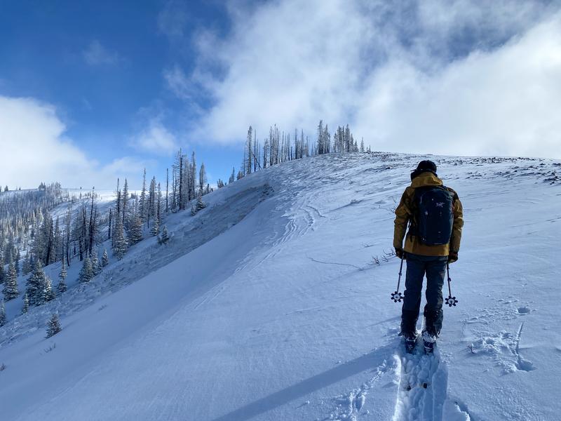
Effects of the winds are evident on the ridge here with cornices. As well as in the second photo, with the winds stripping on the right side of the photo and loading on the left or leeward side of the slope. This snow loaded the persistent weak layer, and we were able to trigger it from a distance.
Today's Observed Danger Rating
Moderate
Tomorrows Estimated Danger Rating
Moderate


