Observation Date
11/24/2024
Observer Name
Nassetta
Region
Uintas » Wolf Creek
Location Name or Route
Wolf Creek Environs
Weather
Weather Comments
After the first wave of snow overnight, the weather was pleasant and calm from the trailhead at 0900 on through the morning. Skies were broken, with periods of overcast throughout the day. Temps were mild and felt warm with short periods of sun breaking through the clouds. Around 1300, another wave of weather entered and winds picked up again from the NW, along with light precip (S-1).
The ceiling dropped, we got hung up on a few clouds at 9,500', and visibility diminished over the next few hours. We returned to the TH at 1500, and skies were parting in the valley and the sun was showing.
Snow Characteristics
New Snow Depth
5"
New Snow Density
Medium
Snow Surface Conditions
Powder
Snow Characteristics Comments
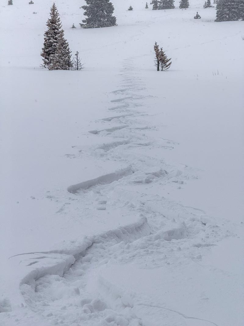
We traveled between 8,500' and 10,000' around Wolf Creek Pass, focusing mainly on northern aspects, as they continue to hold most snow. 'Twas a powder day on the pass today. The late October, and early November storms paid dividends today and helped keep us off the ground, providing some of the better turning and riding conditions this season. Last night, 3-5" of medium-density snow fell on top of variable snow surfaces and bonded very well in most places.
Red Flags
Red Flags
Wind Loading
Cracking
Red Flags Comments
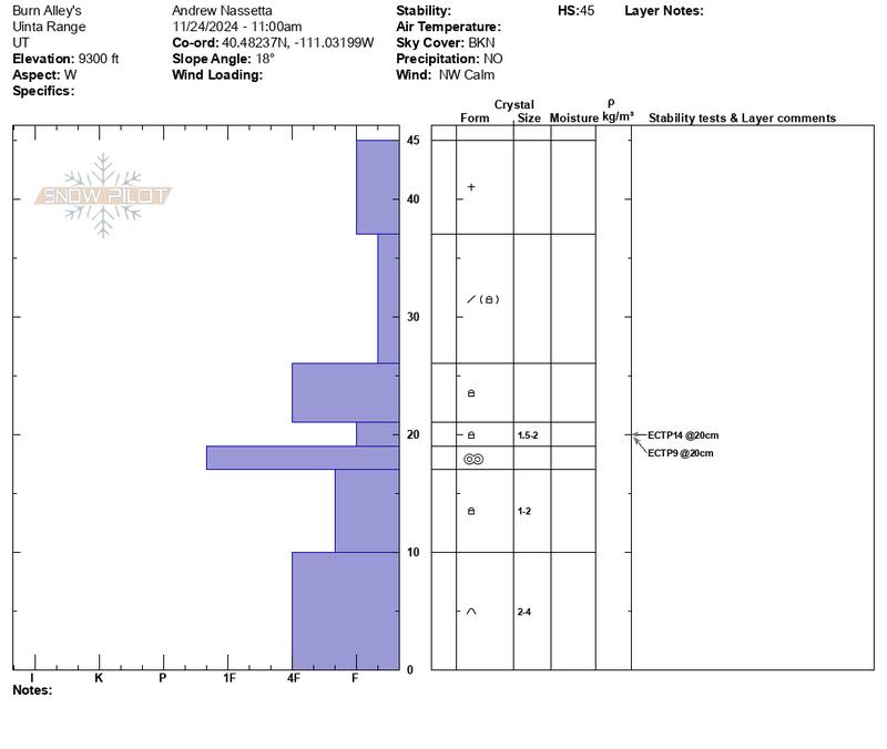
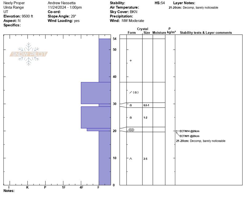
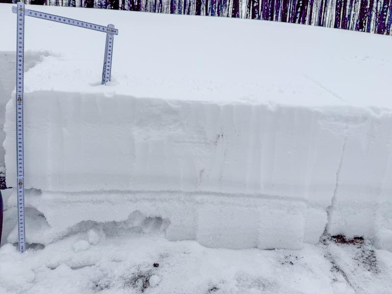
Overall, the structure of the snowpack is very weak and comprised of old snow layers that have mostly gone rotten. The two pits below show this weak snow and lack any evidence of a slab. Although it doesn't present any in-your-face danger in its current state of affairs, the water and snow coming our way mid-week could very well increase the potential of avalanches and we will want to pay attention to that.
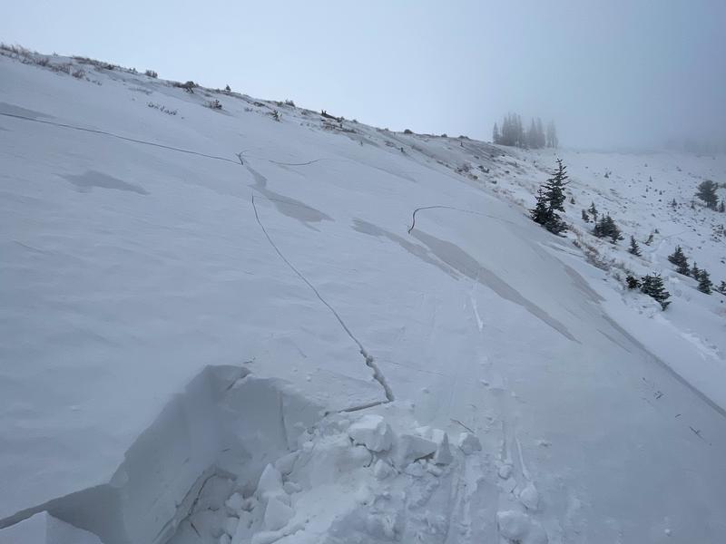
I made note of the leeward sides of ridges and smaller nuanced terrain features that have been cross-loaded by strong S, SW, and W winds recently. We really were on the hunt for the hazard, and I would be pressed to find it in many places that are easily accessible across the range, right now.
Snow Profile Looking at the average depth of the new snow across our travels, between 3-5". In some places, winds created soft drifts within this snow that were not sensitive to the additional weight of a rider and bonded well to the old snow surface.
Recent moderate and strong S, SW, and W winds created a few hard drifts up to 2' deep. Although very challenging to find, it was reactive to the additional weight of a rider and collapsed on the weak, old, October snow.
Soon we will gas up the motor pony, but until then...
Today's Observed Danger Rating
None
Tomorrows Estimated Danger Rating
None
Coordinates
