Sign Up for the Utah Snow and Avalanche Workshop (USAW) on December 7th!

Observation: Fat City

Observation Date
11/8/2024
Observer Name
Hardesty and Wilson
Region
Salt Lake » Park City Ridgeline » Fat City
Location Name or Route
Park City Ridgeline
Weather
Sky
Clear
Wind Speed
Calm
Weather Comments
Glorious.
Snow Characteristics
New Snow Depth
14"
New Snow Density
Medium
Snow Surface Conditions
Powder
Damp
Snow Characteristics Comments
We were able to ski from Guardsman Pass to the PC Ridgeline without taking our skis off. I imagine that one will have to carry skis over melted out zones over the weekend.
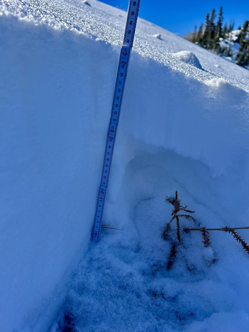
We found soft turns in the weakening snow surfaces (entire pack, actually) on polar aspects although the thin coverage (12-16") on the shady aspects is enough to keep you honest. Sunny aspects are damp.
Red Flags
Red Flags
Poor Snowpack Structure
Red Flags Comments
Poor structure and getting poorer. The weather models have been inconsistent, but not seeing much of an active pattern.
Snow Profile
Aspect
North
Elevation
9,800'
Comments
Snow on the northwest through easterly facing aspects will continue to facet and weaken with continued clear, calm, and cold weather. Solar aspects will likely melt off.
This basal crust exists at and above - rough guess - 9500' or so - remnant snow possibly from the mid-October 17/18 storm. The crust became spotty and then non-existent at 9200' and below. Not surprisingly, weak cold facets were the rule and not the exception. Could be another tricky early season; we'll see.
Today's Observed Danger Rating
None
Tomorrows Estimated Danger Rating
None
Coordinates