Check out our Holiday Auction - Sign Up for the Utah Snow and Avalanche Workshop (USAW)

Observation: Silver Fork

Observation Date
10/29/2024
Observer Name
Kelly
Region
Salt Lake » Big Cottonwood Canyon » Silver Fork
Location Name or Route
East Bowl Pass
Weather
Sky
Overcast
Precipitation
Moderate Snowfall
Wind Direction
Northwest
Wind Speed
Moderate
Weather Comments
Temperatures were cold 20°-22°F. Winds were primarily blowing from a westerly direction and more northwest along the 10,000' ridgetops.
Snow Characteristics
New Snow Depth
6"
New Snow Density
Medium
Snow Surface Conditions
Powder
Snow Characteristics Comments
Took a walk without the skis to see how the new snow bonded to the old snow surface on high north facing slopes. I found 5"-6" of new snow with more drifted in (up to 2') in isolated areas near the ridgetops. The last 1"-2" of new snow was more heavily rimed stellar crystals. In most places this is the only snow on the ground. On north facing aspects above 9,500' there is some old snow on the ground. Prior to the start of the storm there was a freezing rain event and there is a hairthin rain crust on the top of the old snow surface and on rocks starting at 9,000' and upwards in elevation.
Photo of rimed stellar on the surface (west facing aspect 9,400')
Snow Profile
Aspect
North
Elevation
9,900'
Slope Angle
31°
Comments
Shear at old snow surface 4" from the ground and density change 1" from the surface. Photo (2) below of isolated wind drift with a short fracture at 10,000' on an east facing aspect. These wind drifts were up to 2' deep and maybe 10' wide isolated to ridges and the leeward side of terrain features. Crystal card in the photo (1) below marks the old snow surface and the top of the rain layer.
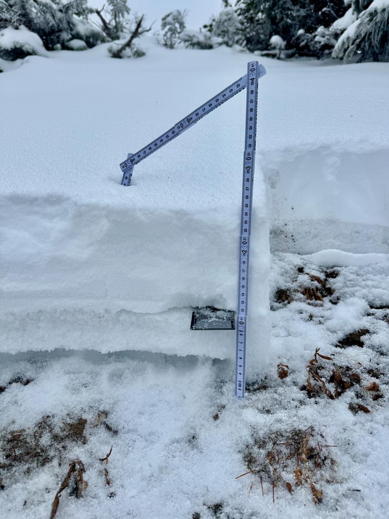
Photo 3- west and southeast facing terrain 10,000'
Photo 4- west and southwest facing terrain 9,100'
Today's Observed Danger Rating
None
Tomorrows Estimated Danger Rating
None
Coordinates