Observation Date
3/31/2024
Observer Name
Hardesty and Wilson
Region
Salt Lake » Big Cottonwood Canyon » Mill D North
Location Name or Route
Mill D North
Comments
Did not note significant wind slab development in our travels. Went to look for possible facets/crust from 3/27 on easterly aspects; they did not reveal themselves in these locations.
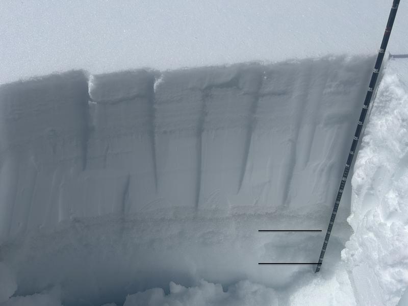
Remember the big warm-up mid March? A 10-15cm thick layer of melt freeze grains 60cm down did not lock-up in the subsequent storms and drop in temps (insulated by the storm snow). I suspect this layering is most pronounced in the mid-elevation easterly aspects. Wet slabs are notoriously difficult to forecast but this layering may be something to keep an eye on.
Note black lines showing the unconsolidated wet mf grains.

Today's Observed Danger Rating
None
Tomorrows Estimated Danger Rating
None
Coordinates


