Observation Date
3/29/2024
Observer Name
Kelly, Babbitt
Region
Salt Lake » Big Cottonwood Canyon » Days Fork
Location Name or Route
Days Fork
Weather
Sky
Few
Wind Direction
Southeast
Wind Speed
Calm
Weather Comments
Light winds at the ridgetops with no current snow transport noted. Clouds started out overcast with high clouds and cleared out allowing for sun affect on the snow surface at all elevations and aspects throughout the day. South, east, and west facing more more sun-affected with north facing terrain stayed dry throughout the morning. Air temperature was still relatively cool ( low to mid 20's °F) and although we talked about green-housing with the filtered clouds we didn't ever feel like it got to that point. There was a slight melt-freeze crust (in the melt phase) on solar aspects.
Snow Characteristics
New Snow Depth
3"
New Snow Density
Low
Snow Surface Conditions
Powder
Snow Characteristics Comments
Snow surface was cold dry snow 2"-3" in early AM hours that became damp throughout the day.
Avalanche Problem #1
Problem
New Snow
Problem #1 Comments
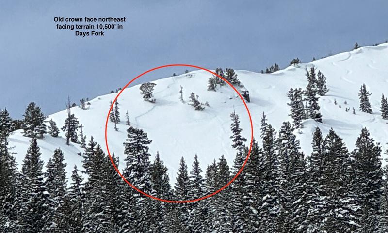
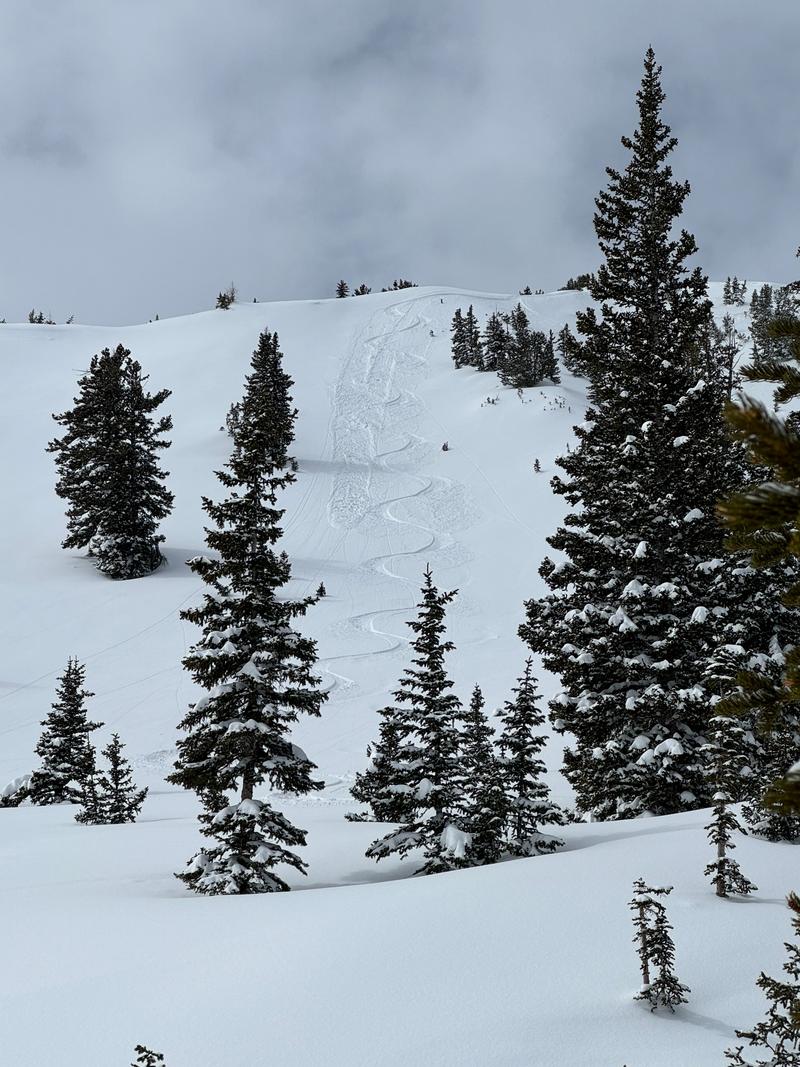
New snow dry loose avalanches 4"-6" on the steepest terrain. Sloughing from ski turns. Some dry loose natual activity noted on steep northerly facing terrain. We also observed a few skier triggered intentional avalanches on steep east facing terrain at and around 9,200'. These were 4"-6" deep slab avalanches that were running above a melt-freeze crust on about an inch of faceted snow (see photo below).
Skier triggered intentionally steep gully east facing terrain 9,100' stacked up in gully feature. Ran on small grained facets above the melt-freeze crust.
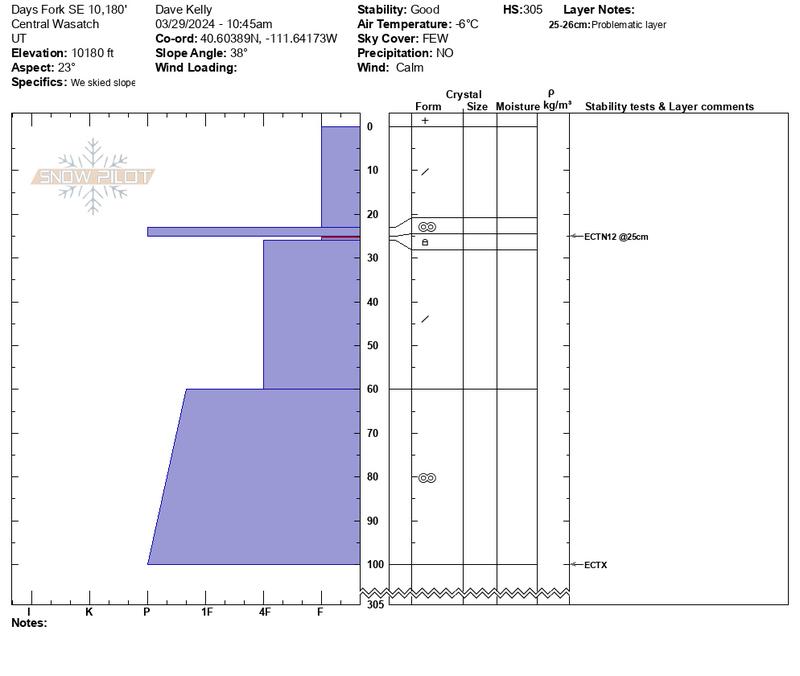
Snow Profile
Aspect
East
Elevation
10,100'
Slope Angle
38°
Comments
Thin gray line about 10"-12" below surface had small grained facets underneath the crust. No density changes noted below that layer. Density changes in the top foot of the snowpack were slight and won't be an issue in the near future. Surface snow was damp and new storm snow should bond well in this location. In this area southeast facing there was no weak snow above the crust like I saw on due east facing terrain.
Above photo of dry loose surface snow avalanches initiated by ski tracks.
Today's Observed Danger Rating
Moderate
Tomorrows Estimated Danger Rating
None
Coordinates