Observation Date
3/22/2024
Observer Name
Tim Matthews, Lance Runyan
Region
Moab » Upper Horse Creek
Location Name or Route
Laurel Highway > Horse Creek.
Weather
Sky
Clear
Wind Direction
Northwest
Wind Speed
Light
Weather Comments
Leaving the TH @0950 the skies were clear and the wind was calm. At the Pre Laurel Peak WX station @1300 winds were light out of the NW temps were just below freezing and a few clouds had starting to make their way onto the scene.
Snow Characteristics
Snow Surface Conditions
Powder
Wind Crust
Melt-Freeze Crust
Damp
Snow Characteristics Comments
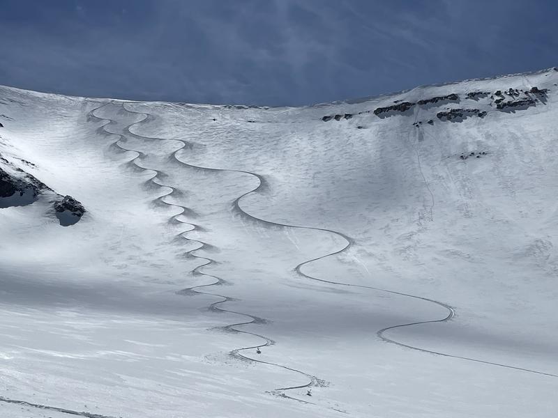
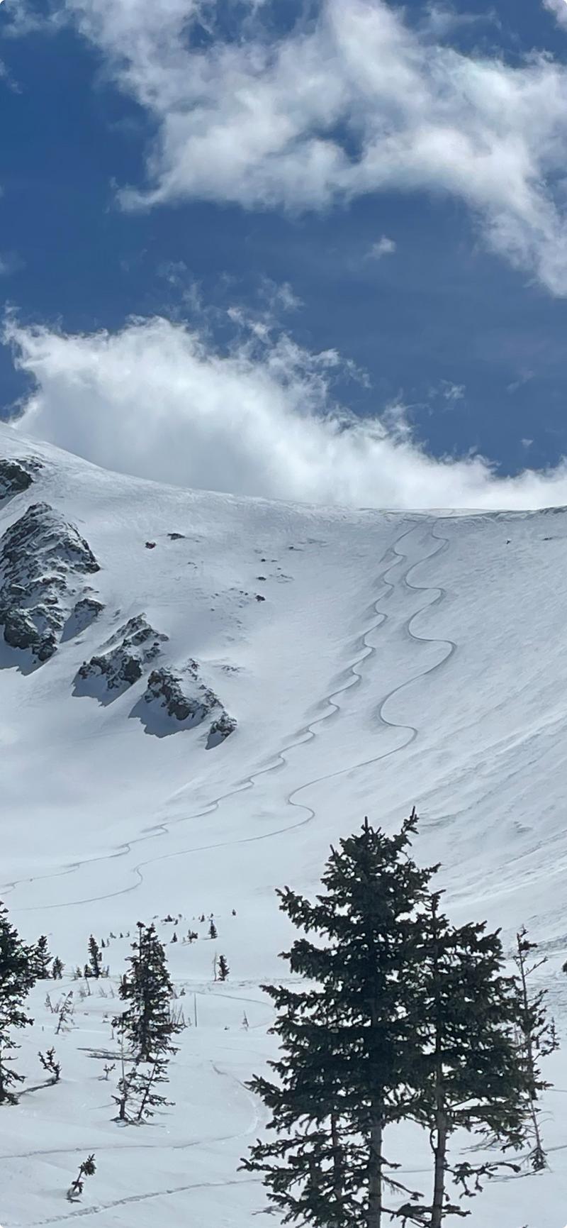
Full spectrum of snow conditions out there as you'd expect to see nearing the end of March. He had melt freeze crust leaving the TH and firm in place skin tracks all the way up the Laurel Highway. Just as we reached terrain above tree line @1145 east facing had taken on enough solar input to soften up the crust and started becoming damp. Out of the parking lot to treeline we observed the formation of surface hoar on a variety of aspects. The strong March sun will take care of the surface hoar on the solar aspects today, but a lack of wind combined with shade and it could preserve and be buried by this next incoming storm. Just something to consider. Finally, the good stuff. High N and NW is still holding cold settled powder that skied quite nice.
Red Flags
Red Flags
Recent Avalanches
Rapid Warming
Red Flags Comments
The strong March sun is doing what it does and the snowpack is taking on solar input on aspects facing E, S, W causing the surface snow to loose cohesion and slide in the form of Wet Loose avalanches. Mostly noted to initiate near rocks that warm much faster than the snow surface itself. From there they are picking up steam and traveling quite a long way down hill packing quite the punch. Although, these avalanches likely wouldn't be large enough to bury you. They do have the ability to pack enough punch to wreck your day, or even your knee. And don't get caught up in one with cliffs below you. The windslabs from earlier this week seem to have settled out and are no longer an issue. No snow transport was observed today.
Avalanche Problem #1
Problem
Normal Caution
Trend
Increasing Danger
Problem #1 Comments
Keep your eyes peeled for how fast the surface snow is taking on heat, and you'll be alright out there. East then south then west in that order. And always remember that a full green compass rose doesn't mean that there is no danger present. This is the season to get into the bigger alpine terrain and ski the stuff we wish we could during the winter. It's also, likely where the most danger is present. That isolated, or extreme terrain. With new snow and wind in the near future (Saturday night) we will likely see an uptick in danger again by Sunday.
Comments
Surface Hoar formation below treeline on all aspects was observed today. The strong sun will melt it off on the solar aspects, but it would stay preserved and be buried with the start of the weekend storm.
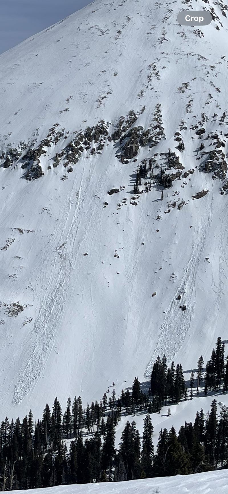
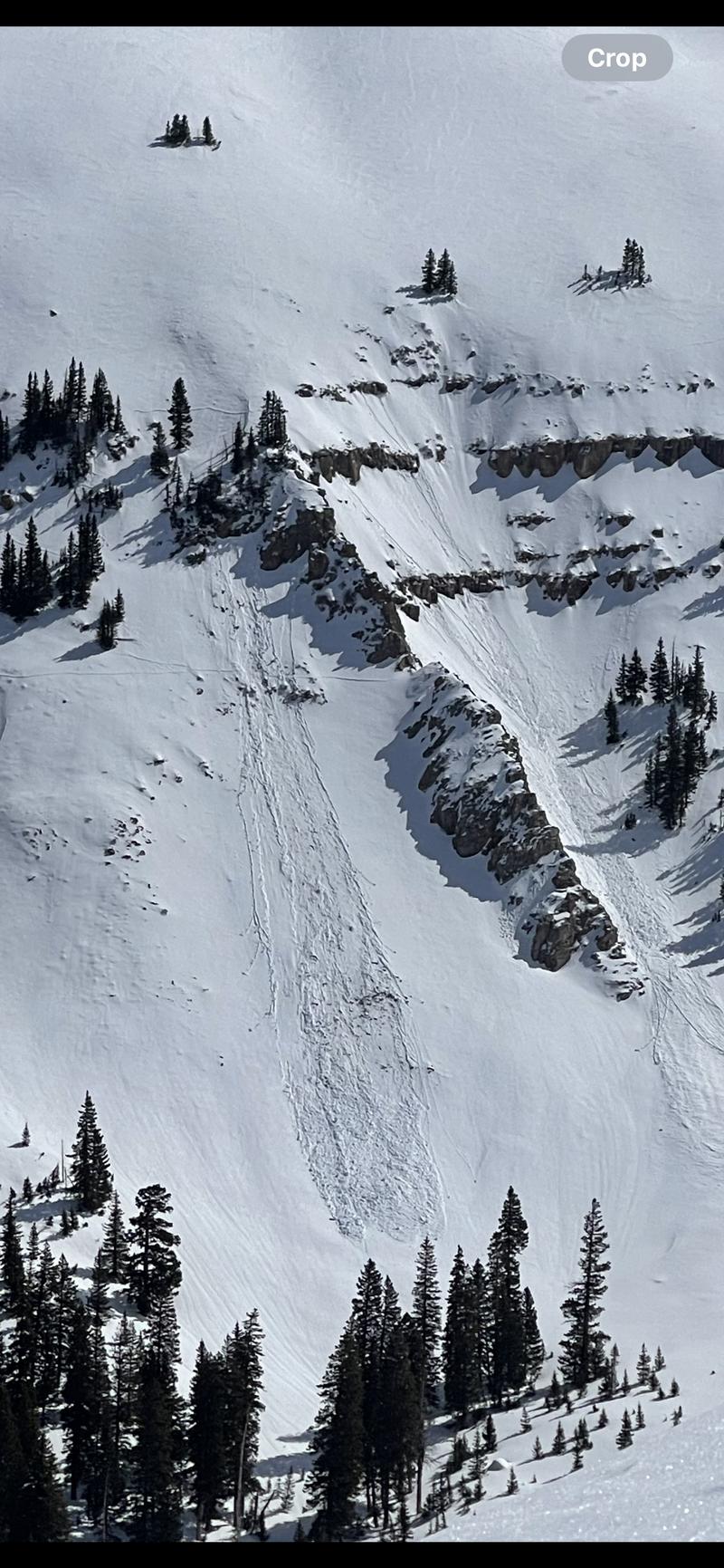
A couple wet loose avalanches off of Mt. Mellethin's west face. They did not happen today, but steep rocky terrain this like could still keep producing them as the crust burns off and softens up solar aspects. By 1345 I could step out of my skis and get a boot top foot penetration in snow that was crusted over a few hours earlier. This is telling me that the surface snow is taking on heat and becoming unconsolidated and more dangerous. Time to find colder snow.
NW Horse Creek held cold dry settled powder and was a treat to ski while all the solar aspects were getting hammered by the sun.
Today's Observed Danger Rating
Low
Tomorrows Estimated Danger Rating
Low
Coordinates