Observation: Mary Ellen Gulch

Observation Date
2/11/2024
Observer Name
Zimmerman-Wall
Region
Provo » American Fork » Mary Ellen Gulch
Location Name or Route
Sinner's Pass/Mary Ellen Gulch
Weather
Sky
Scattered
Wind Direction
Northeast
Wind Speed
Moderate
Weather Comments
Winds were the headline. Moderate NE from 830 am onward. Transporting snow along the 10,000' ridgelines. Cold temps to start but warmed throughout the morning. Unrelenting sunshine in the American Fork Canyon. Increasing cloud in the lower and mid Little Cottonwood Canyon going to overcast by 4pm.
Snow Characteristics
New Snow Depth
1"
New Snow Density
Low
Snow Surface Conditions
Powder
Damp
Snow Characteristics Comments
Low density snow overnight (1") with some wind texture from the increase in speeds early morning. The storm snow from the last 3 days is slowly settling and providing faster riding conditions. Also optimal for transport. The Southern aspects were picking up some heat and should be crusted tomorrow.
Red Flags
Red Flags
Recent Avalanches
Wind Loading
Cracking
Poor Snowpack Structure
Red Flags Comments
Plenty of evidence of instability today. Just look at the Avalanche list.
Avalanche Problem #1
Problem
Wind Drifted Snow
Trend
Increasing Danger
Problem #1 Comments
More in your face than forecast. This was the main concern for me on my travels today.
Avalanche Problem #2
Problem
Wet Snow
Trend
Same
Problem #2 Comments
Sun angles have changed and the snow knows it.
Snow Profile
Aspect
Southwest
Elevation
9,900'
Slope Angle
25°
Comments
Photo:
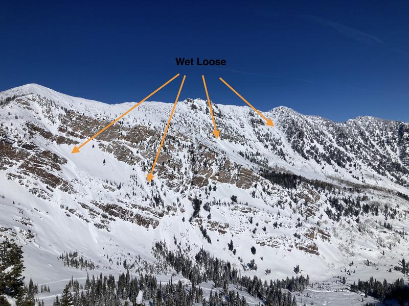
1. Wet Loose on South facing upper AF canyon behind Sugar Loaf Peak and Devils Castle
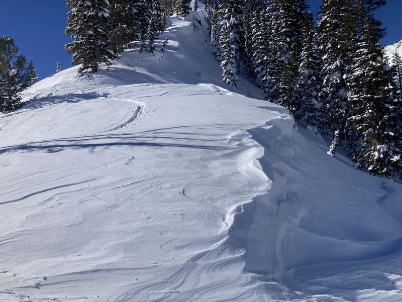
2. Reverse loading from the NE winds- cornice erosion
3. Loading from NE- cornice formation
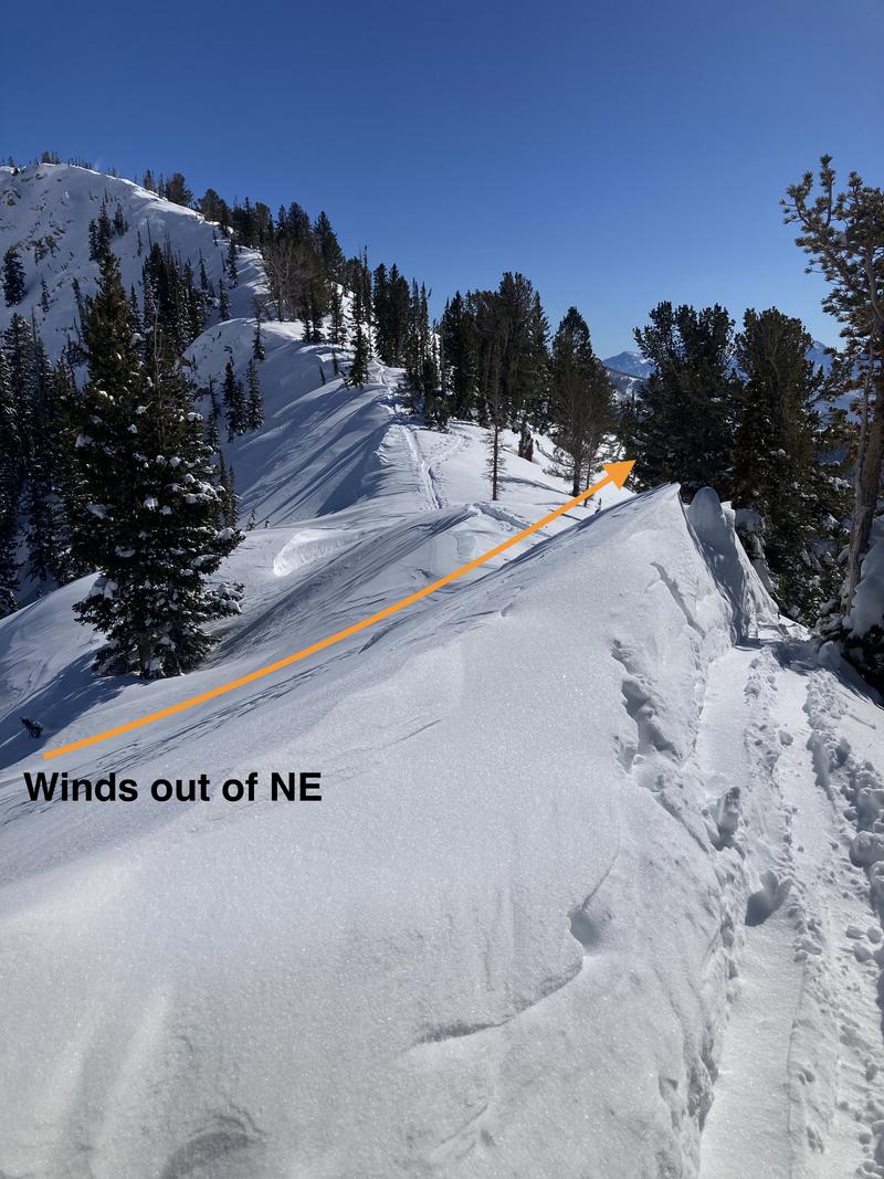
4. Wind slab formation on ridgeline of Pagan Basin/Mary Ellen Gulch
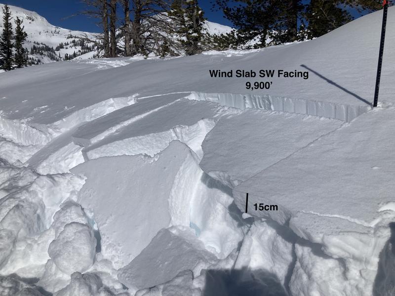
5. Video- ECTP 1 failing on new snow below a recently developed wind slab at 9,900' SW facing slope
Video
Today's Observed Danger Rating
Considerable
Tomorrows Estimated Danger Rating
None
Coordinates