Observation: Cardiff/Mineral

Observation Date
1/30/2024
Observer Name
Kelly, Pressman
Region
Salt Lake » Big Cottonwood Canyon » Cardiff/Mineral
Location Name or Route
Cardiff Peak-Cardiac Ridge
Weather
Sky
Clear
Wind Direction
West
Wind Speed
Light
Weather Comments
Winds picked up blowing lightly from the west on the ridgetops over 10,600'. Calm to no wind in the drainages and at the 10,000' ridgelines. It was warm and sunny and felt like a spring day. We started early and finished early to avoid and wet snow issues.
Snow Characteristics
Snow Surface Conditions
Faceted Loose
Melt-Freeze Crust
Damp
Snow Characteristics Comments
Solar aspects were melt-freeze crust at 0700AM and by 1130 were starting to soften up on west-southwest facing aspects. It was still supportable when we descended on the southerly aspects, but I would not have wanted to be out there much later than we were. See report of an avalanche we observed in 2 trees from yesterday afternoon January 29th. More protected north-northeast aspects had surface hoar and near surface facets with a light crust on the easterly aspects at higher elevations.
Red Flags
Red Flags
Recent Avalanches
Rapid Warming
Poor Snowpack Structure
Avalanche Problem #1
Problem
Persistent Weak Layer
Trend
Same
Problem #1 Comments
We went to look at the recently reported avalanche dry snow (PWL failed on facets) on west facing Mineral Fork. This avalanche appeared to have failed on faceted snow near the ground. It looks like it was triggered by wet snow falling off the cliff band and was on a west facing slope on the riders right side (west facing) Room of Doom at 10,400' most likely on January 28, 2024. There were nearby skin and ski tracks and this avalanche ran into the flats approximately 600' vertical.
Avalanche Problem #2
Problem
Wet Snow
Trend
Same
Problem #2 Comments
As long as daytime temperatures push we are going to continue to have wet snow problems. Cold temperatures at night are keeping things in check but this is a problem that can be managed by avoiding solar aspects later in the day and working the compass to avoid being in, under, or on steep solar aspects during the heat of the day. When base temps start to get over 45 °F in January things get weird. See link to 2 trees avalanche from January 29, 2024 and glide avalanches starting to open up in Mineral Fork.
Snow Profile
Aspect
Northwest
Elevation
10,100'
Comments
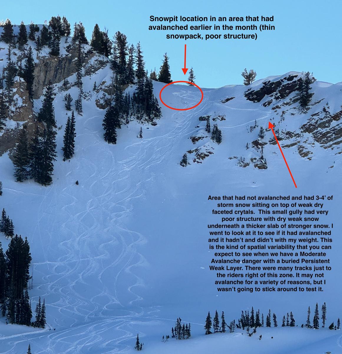
Above photo - description of spatial variability during Moderate Danger with a buried PWL
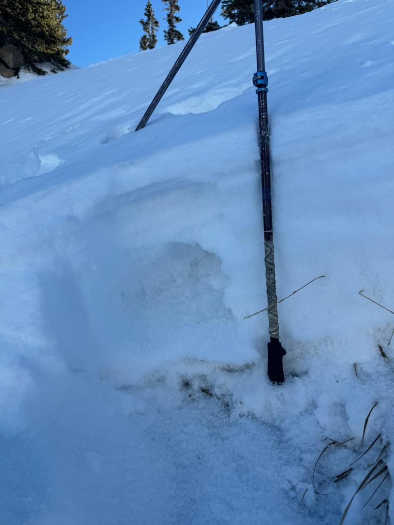
Photo 1- weak structure between 2 deteriorating crusts
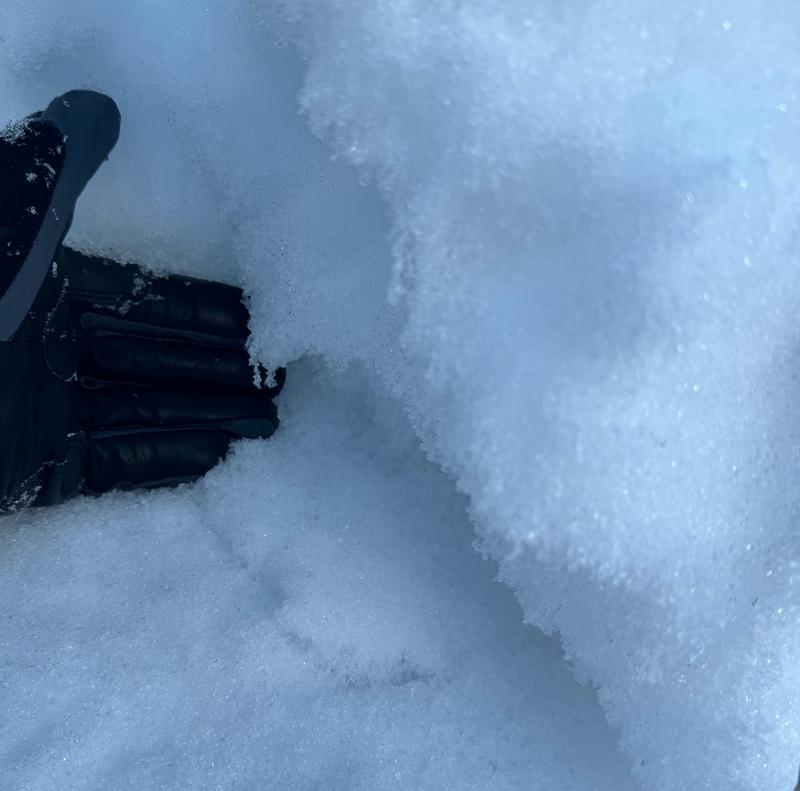
Photo 2- Photo of weak dry faceted grains
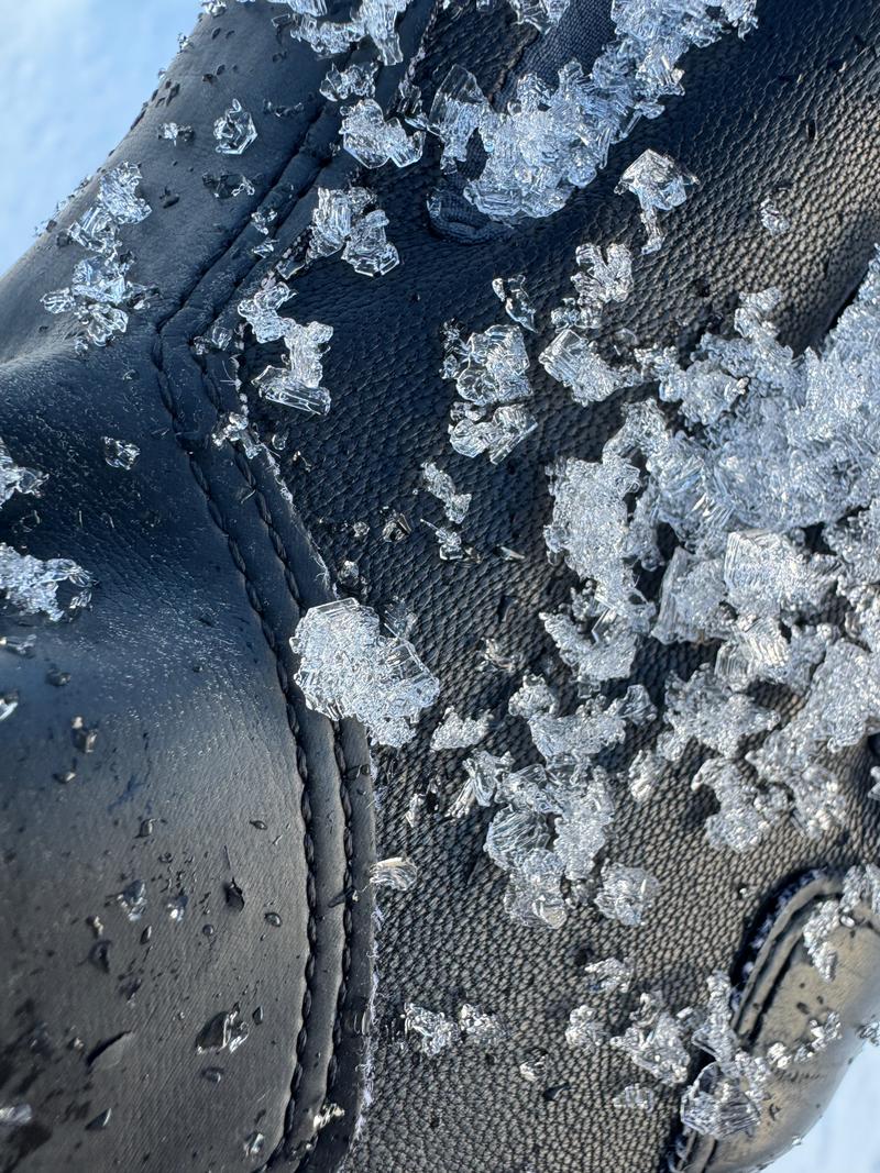
Photo 3- chained facets (means they are very weak and have had lot of time to get weaker)
Today's Observed Danger Rating
Moderate
Tomorrows Estimated Danger Rating
Moderate
Coordinates