
Observation Date
12/25/2023
Observer Name
Kelly, Kazickas
Region
Logan » Garden City Canyon » Garden City Bowls
Location Name or Route
Garden City Bowls
Comments
Photo below showing the snowpit wall. Where the card is placed a couple inches below the surface is the bottom of a weak old snow interface with broken stellar crystals and older sugary snow crystals from prior to the last couple of inches of new snow. Total height was 97cm ( 3'). Snowpack is showing signs of improved stability with ECT (extended column tests) having harder results (ECTP21@0). The temperature gradients (red line in the snowpit above) show a very strong temperature gradient in the upper snowpack. We also noted sparkly near surface facets on all aspects and in the bottom photo you can see the sparkly near surface facets reflecting back at the camera. On West facing slopes these NSF were starting to deteriorate when we skied out.
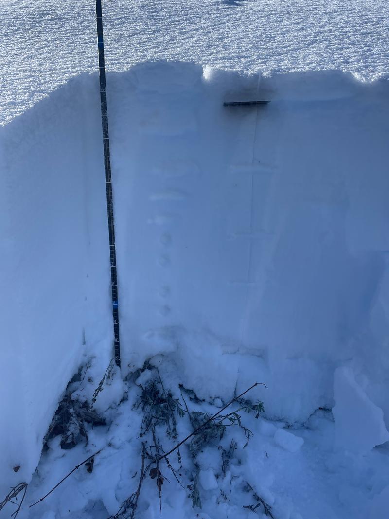

Photo of snow surface showing sparkly near surface facets with Bear Lake in the background.
Today's Observed Danger Rating
Low
Tomorrows Estimated Danger Rating
Low
Coordinates


