Check out our Holiday Auction - Sign Up for the Utah Snow and Avalanche Workshop (USAW)

Observation: Empire Pass

Observation Date
12/18/2023
Observer Name
Torrey
Region
Salt Lake » Park City Ridgeline » Empire Pass
Location Name or Route
Empire Pass
Weather
Sky
Broken
Wind Direction
South
Wind Speed
Moderate
Weather Comments
Warm temperatures. Moderate south winds with occasional strong gusts. Drifting snow to Lee of immediate ridge tops.
Snow Characteristics
Snow Surface Conditions
Faceted Loose
Wind Crust
Damp
Red Flags
Red Flags
Wind Loading
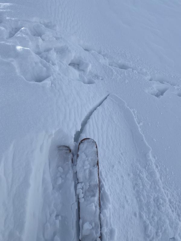
Cracking
Poor Snowpack Structure
Red Flags Comments
Unseasonably warm temperatures but not rapid.
Avalanche Problem #1
Problem
Wind Drifted Snow
Trend
Decreasing Danger
Problem #1 Comments
New slabs of wind-drifted snow forming on the lee of ridge top slopes. There is relatively minimal snow available to drift however thin slabs up to 4 inches thick were easy to provoke on test slopes.
Avalanche Problem #2
Problem
Persistent Weak Layer
Trend
Decreasing Danger
Problem #2 Comments
Facets are still present near the ground. They are gaining strength but not showing signs of rounding. The upper snowpack is weakening but the midpack is still supportive in most areas. Avalanches failing near the surface will be my initial concern but at the moment I wouldn't rule out basal layers becoming reactivated again.
Snow Profile
Aspect
North
Elevation
9,000'
Slope Angle
24°
Comments
Photo 1: Cracking in the recently wind-drifted snow ~ 4 inches thick.
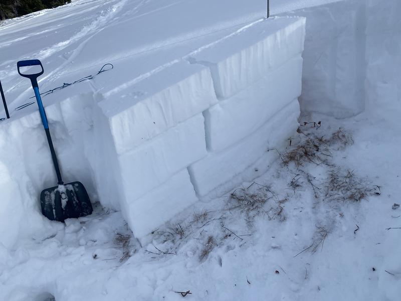
Photo 2: Multiple slab fracture results in PST. No real significance to the observation just thought it was cool!
Today's Observed Danger Rating
Low
Tomorrows Estimated Danger Rating
None
Coordinates