Observation Date
12/10/2023
Observer Name
Brackelsberg
Region
Salt Lake » Park City Ridgeline
Location Name or Route
PC Ridgeline
Weather
Sky
Overcast
Wind Direction
West
Wind Speed
Strong
Weather Comments
As the sun came out in the early afternoon, the snow below 8,500' had some greenhousing.
Snow Characteristics
New Snow Depth
10"
New Snow Density
Low
Snow Surface Conditions
Powder
Red Flags
Red Flags
Poor Snowpack Structure
Avalanche Problem #1
Problem
Persistent Weak Layer
Trend
Same
Problem #1 Comments
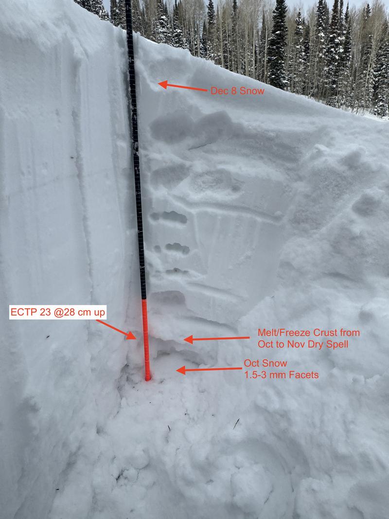
Early in the season the Murdock area generally has a very wea snowpack with a significant amount of facets on the ground. We were surprised the relative stability of the snowpack. We were expecting it to be much more reactive to our extended column test (ECT) than the ECTP 28 result that we got. This matched the PWL avalanche problem in the forecast of being unlikely. Our ECT result of breaking into the basal faceted layer also matched the PWL problem of a slide being relatively large if it does break.
Snow Profile
Aspect
Northeast
Elevation
8,900'
Slope Angle
23°
Comments
The early October snow was capped with a 4cm melt/freeze crust. There was significant faceted snow above and below the crust. The thick 4F snow above this lead to good support on skis, but when you stepped out of your skis, you sunk to the bottom of the snowpack.
Today's Observed Danger Rating
Moderate
Tomorrows Estimated Danger Rating
Moderate
Coordinates