Observation Date
12/2/2023
Observer Name
Brackelsberg
Region
Salt Lake » Park City Ridgeline » Empire Pass
Location Name or Route
Empire Pass
Weather
Sky
Obscured
Precipitation
Light Snowfall
Wind Speed
Moderate
Weather Comments
Steady light snow all morning.
Snow Characteristics
New Snow Depth
13"
New Snow Density
Low
Snow Surface Conditions
Powder
Snow Characteristics Comments
We were surprised by the amount of new snow. It ranged from 12-14" with some places favored by wind being deeper/
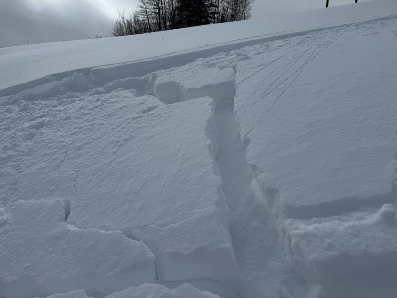
The snow was very low density and you could feel the thin crust under the new snow as you descended.
Red Flags
Red Flags
Cracking
Poor Snowpack Structure
Red Flags Comments
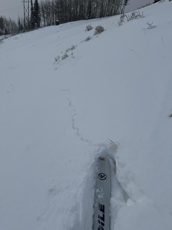
We had numerous cracks with some of them shooting over 15M.
The old snow was a thin crust with facets to the ground below it and a thin layer of facets on top of it.
Avalanche Problem #1
Problem
New Snow
Trend
Increasing Danger
Problem #1 Comments
With 12-14" of new snow on the facet/crust combo on steeper terrain it would be easy to get the new snow to avalanche. If the storm comes in wet as predicted, it could easily overload the snowpack. If this occurs, I would expect both natural and human triggered avalanches.
Snow Profile
Aspect
North
Elevation
9,000'
Comments
We had numerous shooting cracks during our travels. Some were able to spider out and some propagated ~15M.
On slopes over 30 degrees were were able to get a small amount of snow movement of the new snow on the thin layer of facets on top of the weak crust. On larger or steepers slopes this could create a decent size avalanche.
Today's Observed Danger Rating
Considerable
Tomorrows Estimated Danger Rating
Considerable
Coordinates