Check out our Holiday Auction - Sign Up for the Utah Snow and Avalanche Workshop (USAW)

Observation: South Face

Observation Date
3/27/2023
Observer Name
W Ambler
Region
Salt Lake » Lone Peak » South Face
Location Name or Route
Heaven's Halfpipe
Weather
Sky
Scattered
Wind Direction
South
Wind Speed
Light
Weather Comments
Heavens halfpipe run was obscured by clouds for most of the day and was not affected by recent strong winds. The sun was powerful and quick to affect the snow surface when it peaked out behind the clouds.
Snow Characteristics
New Snow Depth
6"
New Snow Density
Low
Snow Surface Conditions
Powder
Melt-Freeze Crust
Damp
Snow Characteristics Comments
Below the second hamongog the snow surface warmed up. In the evening, it cooled off. This left a breakable mf crust creating some exciting, knee twisting ski conditions. Above the second hamongog there is a significant amount of low density snow available for wind transport and public enjoyment.
Red Flags
Red Flags
Recent Avalanches
Heavy Snowfall
Rapid Warming
Red Flags Comments
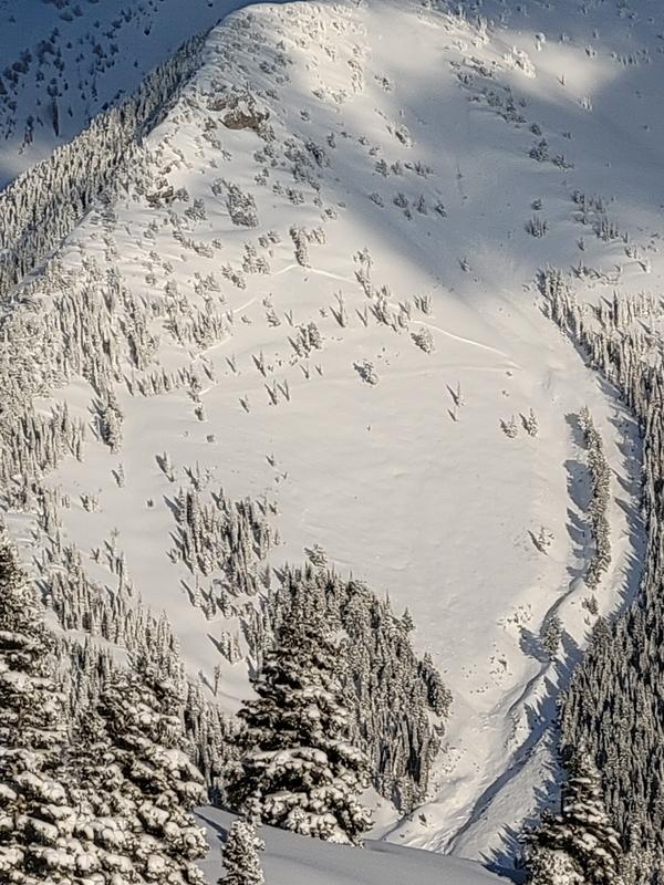
Widespread natural avalanching this morning and last night, presumably during periods of high PI; soft slabs and dry loose. However most of these slides were within the newest snow, top 6 inches. Their were a few slides that had stepped down into older layers or had slid previously and subsequently been buried. One of note occurred on the westernmost slope of Box Elder. Details were hard to gather from a distance. However it looks like it could easily been a foot+ deep, 500' wide and 1000+' long.
Comments
Squint and you'll see the box elder slide pictured below.
Today's Observed Danger Rating
Considerable
Tomorrows Estimated Danger Rating
Moderate
Coordinates