Check out our Holiday Auction - Sign Up for the Utah Snow and Avalanche Workshop (USAW)

Observation: Salt Lake

Observation Date
3/21/2023
Observer Name
Williams / Pekarek
Region
Salt Lake
Location Name or Route
Willow Knob
Red Flags
Red Flags
Recent Avalanches
Wind Loading
Poor Snowpack Structure
Avalanche Problem #1
Problem
New Snow
Trend
Decreasing Danger
Problem #1 Comments
~32 degree test slope at about 8,500 feet by Blue Bunny: new snow was adhering well to the old snow surface.
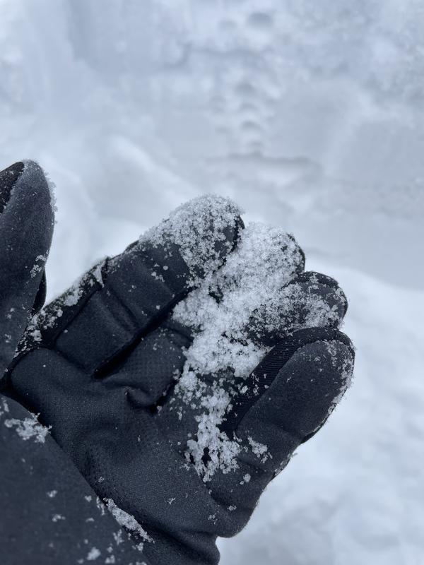
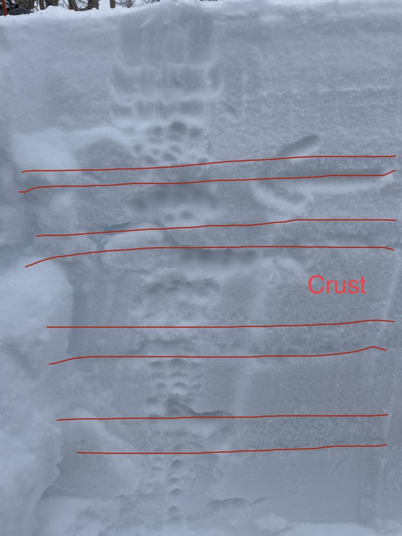
Dug a quick and shallow pit at 9,300 feet on a south-facing, ~20 degree slope that was representative of what we were hoping to ski. It looked like a layer cake (photo 1: ~10 inches of soft storm snow, crust, snow, crust, etc. with some faceting snow adjacent to each of the crusts - see photo 2). Right side up overall but the crusts just kept coming, and the third crust down was knife hardness.
Burped the shovel and performed an ECT: new snow was reactive but not cohesive, so we decided to ski it one at a time right around 30, spotting one another from islands of safety. We didn't see any avalanche activity, and the snow was great but variable.
Avalanche Problem #2
Problem
Wind Drifted Snow
Trend
Increasing Danger
Problem #2 Comments
Winds were mostly out of the southeast during our tour (5:30-8 pm), and we saw plenty of snow getting transported towards and over the ridgeline (the skinner got entirely filled in while we dug our pit).
Snow Profile
Aspect
South
Elevation
9,300'
Today's Observed Danger Rating
Moderate
Tomorrows Estimated Danger Rating
Moderate
Coordinates