Observation: Salt Lake

Observation Date
3/14/2023
Observer Name
Kelly, Kelly, Pressman
Region
Salt Lake
Location Name or Route
South/North Willow Creek
Weather
Sky
Scattered
Precipitation
Moderate Rain
Wind Direction
Southwest
Wind Speed
Strong
Weather Comments
Day started with scattered skies moving to overcast skies with moderate rain up to 7,000' later in the afternoon. Winds were southwest in the canyon and southeast at the 7,000' ridgetops. Steady strong east winds at the mouth of the canyon. Rain/snow line was close to 7200' although temperatures at 7,000 were closer to 36˚F.
Snow Characteristics
New Snow Density
High
Snow Surface Conditions
Damp
Snow Characteristics Comments
Snow surface was damp to very saturated. South-west facing slopes had spotty snow coverage. North facing slopes at 7,000 were about 120 cm (4') and were a saturated surface with weak moist faceted crystals on the ground. Steep north facing (over 35 degrees) had roller balls averaging 1' up to 2' in diameter. South-west facing slopes the top 4" of the snow surface sluffed off easily. We noted rollerballs on north-west facing slopes up to 7200'.
Photo of northwest facing slopes at 7,100'
Photo of south facing slopes at 6,400'
Red Flags
Red Flags
Recent Avalanches
Rapid Warming
Poor Snowpack Structure
Avalanche Problem #1
Problem
Wet Snow
Trend
Increasing Danger
Problem #1 Comments
Snowpack was wet and mushy. We got close to North Willow Creek and both the north and south facing terrain was mushy and as soon as we found ourselves sinking to mid-calf on south facing slopes we put skins back on and retreated to lower angle slopes and ridgetops as a better exit strategy. The steep north facing terrain was eery and I won't go back to steep north facing terrain below 6.600' until it has had a solid refreeze. This trend will increase until it freezes or melts at this elevation.
Snow Profile
Aspect
Southwest
Elevation
6,700'
Slope Angle
21°
Comments
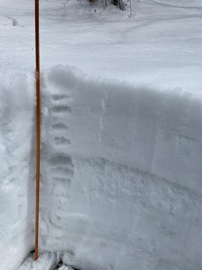
Thin shallow wet snowpack on south-west facing terrain at this elevation. I can't imagine it will make it through a rain event and any spring sunshine. Compression tests showed a collapse (SC) at 69 cm from the ground. The snow was well anchored in by scrub oak or rocks and we were only able to get sluffing in the top 4" of the snowpack with isolated roller balls eating themselves up at this aspect and elevation. North facing was a different story and is not something I would mess with until it freezes or melts.
We saw evidence of a large natural cycle in North Willow Creek. We exited the tree line onto a huge pile of avalanche debris with damaged aspens and evergreen trees. The avalanche looked to have run 2500'. The max run-out potential for this zone would have been closer to 3,000' and we saw signs of avalanches running this distance in the bent over aspens groves and flagging on trees.
Today's Observed Danger Rating
Moderate
Tomorrows Estimated Danger Rating
None
Coordinates