
Observation Date
3/8/2023
Observer Name
Hardesty
Region
Salt Lake » Big Cottonwood Canyon » Brighton Perimeter » Lacawaxan
Location Name or Route
Lacawaxen
Comments
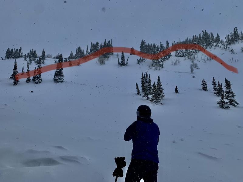
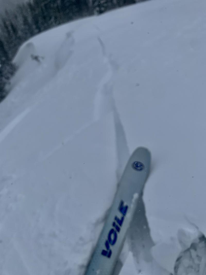
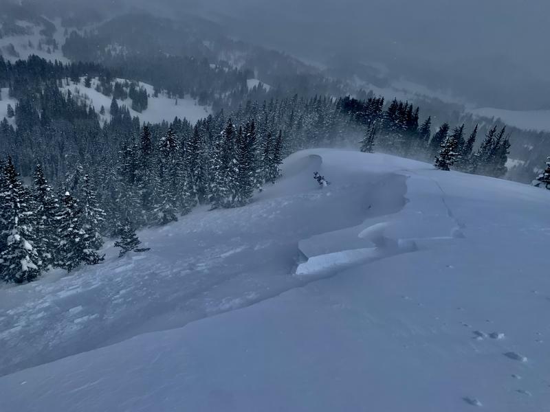
Only time for a short outing. Travel was out of Brighton's Great Western gate, north to 10,420', descending the east ridgeline and wrapping back around to look at this avalanche (photo below), reportedly triggered from below (remotely) by a snowmobiler on Monday. This 1-2' deep and 200' wide avalanche is on the SE face of 10,420' at roughly 10,100'.
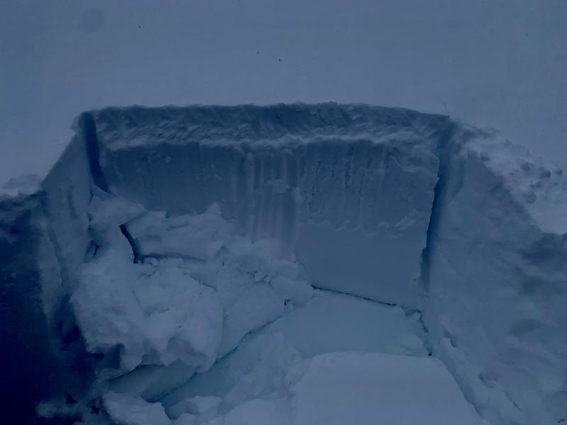
I dug both adjacent to the crown and at another location with a SE aspect and could not elicit any shears (ECTX) above Thursday's sun crust. Scope revealed decomposing and fragmented low density snow just above this crust....(this structure being the culprit in at least 7 human triggered avalanches Sunday and Monday). No collapsing or cracking in this layering was noted. I believe that this unstable structure has probably healed...only to have this interface again greatly stressed over the next two to three days. We'll see.
The prefrontal southwest winds picked up late morning and were easily transporting snow, making it easy to trigger soft cornices and shallow 6-8" soft slabs of wind drifted snow to the lee of 10,420's east ridge.
With tonight's expected new snow and tomorrow's expected partial clearing and rapidly warming temperatures, both loose dry and not insignificant loose wet avalanches in this new snow can be expected on their respective sun/shade aspects.
Today's Observed Danger Rating
Moderate
Tomorrows Estimated Danger Rating
None
Coordinates


