Observation Date
3/5/2023
Observer Name
Hardesty, Kelly
Region
Salt Lake » Little Cottonwood Canyon » Cardiff Pass
Location Name or Route
Cardiff Pass
Weather
Sky
Overcast
Wind Direction
South
Wind Speed
Light
Weather Comments
Skies were mostly overcast with breaks of blue throughout the afternoon. Winds were primarily from a southerly direction with gusts from the southwest and southeast. Later in the day winds were touching down to 8800' and blowing more westerly. Lots of snow available for transport.
Snow Characteristics
New Snow Depth
15"
New Snow Density
Medium
Snow Surface Conditions
Powder
Snow Characteristics Comments
Good skiing with some wind-affected snow closer to the ridgelines. We didn't observe any cracking or collapsing although you could feel a spongy layer at the new/old interface above the crust.
Red Flags
Red Flags
Recent Avalanches
Heavy Snowfall
Wind Loading
Red Flags Comments
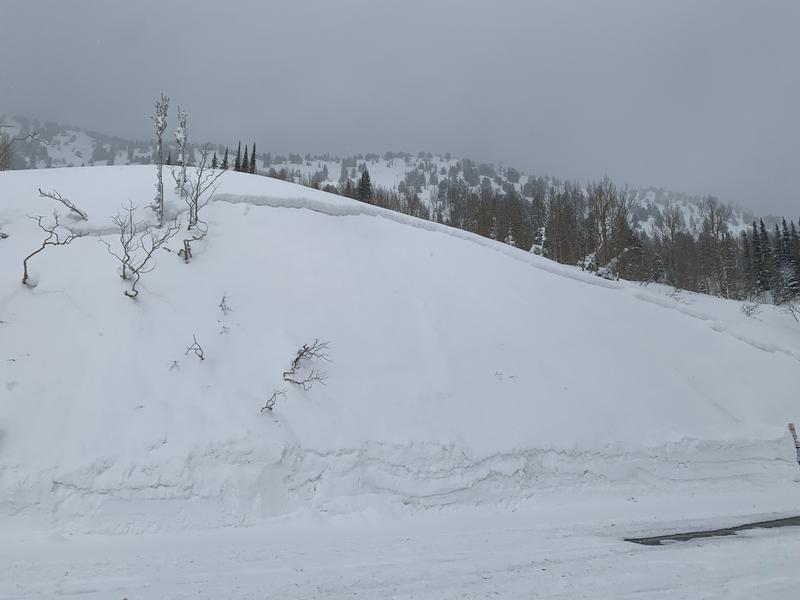
Lots of snow and wind over the last 24 hours. We saw signs of recent avalanche activity from the control work that UDOT did above Highway 210. Longest running avalanche we observed during our tour was on southwest facing Toledo Bowl. We also observed cut banks that had avalanche crowns above the highway west of the Grizzly parking lot (bottom photo).
Avalanche Problem #1
Problem
Wind Drifted Snow
Trend
Increasing Danger
Problem #1 Comments
Lots of snow available for transport with forecasted wind. We observed active loading throughout the tour on leeward aspects and at ridgetops.
Avalanche Problem #2
Problem
New Snow
Trend
Same
Problem #2 Comments
New snow instabilities were 1' and 2' down with extended column tests with no propagation 1' down and extended column test with propagation 2' down. These instabilities should settle out. These tests were performed out of the wind zone on a more easterly aspect @9600' in an area that was not wind-loaded.
Snow Profile
Aspect
Southeast
Elevation
9,800'
Comments
In this location the only failure was 3" above the old melt-freeze crust. 100' higher in elevation closer to the ridge in an area that was more wind-affected it was easier to tease out the instabilities within the new snow where the hand hardness changes from fist to four-finger in this photo. I did not check for propagation in this location.
Today's Observed Danger Rating
Considerable
Tomorrows Estimated Danger Rating
Considerable
Coordinates