Observation Date
3/3/2023
Observer Name
Meisenheimer / Hill
Region
Ogden » Ben Lomond » Cutler Ridge
Location Name or Route
Cutler Ridge
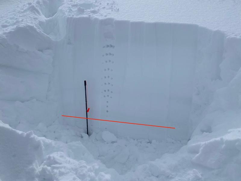
Comments
The red line in my photo represents what we think is the old snow / new snow interface.
Today's Observed Danger Rating
Moderate
Tomorrows Estimated Danger Rating
Moderate
Coordinates