Observation: Ben Lomond

Observation Date
2/7/2023
Observer Name
Trenbeath, Groves, Davis
Region
Ogden » Ben Lomond
Location Name or Route
Cutler Ridge - Ben Lomond
Weather
Sky
Few
Wind Direction
Northwest
Wind Speed
Light
Weather Comments
Beautiful day with sunshine, a few in and out low clouds, and light winds.
Snow Characteristics
Snow Surface Conditions
Powder
Dense Loose
Wind Crust
Snow Characteristics Comments
We went up Cutler Ridge to the summit of Ben Lomond, then back down dropping into Bailey's. then back up and over Cutler Ridge and out Cutler Creek. 5"-9" of snow fell in the area between Feb 5-6. Snow right at treeline and above was wind affected, especially on the NE Face of Ben Lomond. No surprise there. I found recent, stiff wind drifts from 6"-18" deep but they seemed pretty isolated. I also skied around a bit with patrol at Snowbasin the day before. Mitigation work there produced isolated storm and wind slabs 6"-10" deep. I didn't observe any cracking, and wasn't able to get anything to move on test slopes. We didn't observe any instabilities in the most recent storm snow today. Solar aspects took on plenty of sun and will be crusted over tomorrow. Sheltered terrain below treeline offered great turning and riding in soft, settled powder. I noted some surface hoar development on an east aspect but it wasn't widespread and I suspect it will soon get beat down by sun and wind.
Effects of the wind began right near treeline.
NE face of Ben Lomond was heavily wind affected with alternating scoured and wind loaded zones with lots of cross loading evident. There wasn't a lot of connectivity between drifts, but plenty of places where it looked like a pocket of wind drifted snow could be troublesome.
Surface hoar on an easterly aspect around 8000'.
Red Flags
Red Flags
Wind Loading
Avalanche Problem #1
Problem
Wind Drifted Snow
Problem #1 Comments
Wind drifted snow remains a concern on all aspects primarily above treeline. Drifts are stiff and stubborn and you may be committed to a slope before they release.
Snow Profile
Aspect
East
Elevation
7,500'
Slope Angle
20°
Comments
I dug a quick pit on an easterly aspect at 7500' thinking it may be similar to the Willard Peak incident. I could see an obvious interface in at the bottom of the most recent storm snow, and identified a thin layer of small grained facets about 45 cms down. ECT and CT tests did not produce results but there was an obvious sheer plane.
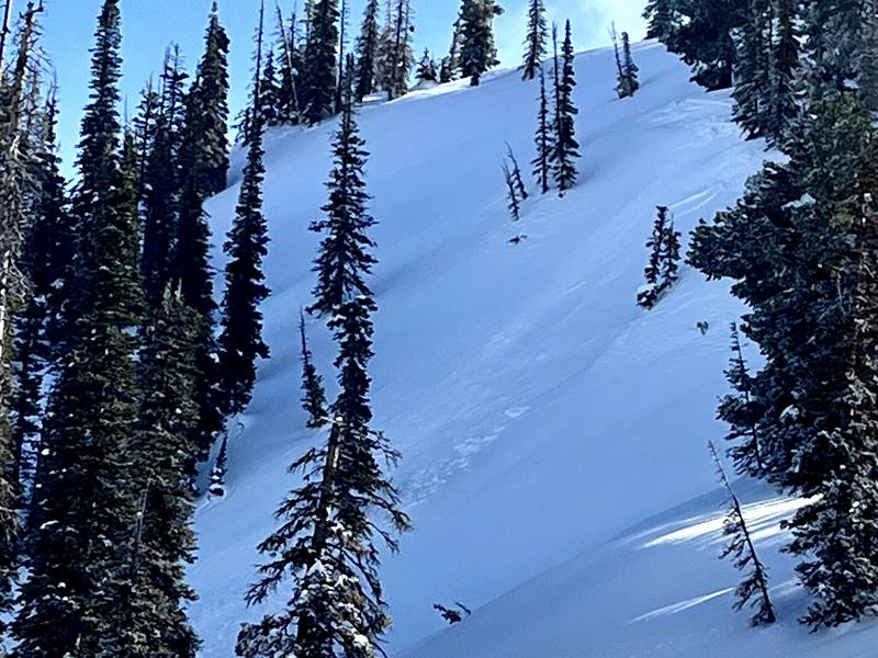
We observed one small, natural wind slab release on a slightly corniced sub-ridge that was about 6" deep, 15'-20' wide, that ran about 50'. I stomped around on an adjacent wind drift and couldn't get it to budge or crack.
Today's Observed Danger Rating
Moderate
Tomorrows Estimated Danger Rating
Moderate
Coordinates