Observation: Beaver Mountain Backcountry

Observation Date
2/6/2023
Observer Name
Richie Schumacher
Region
Logan » Beaver Mountain Backcountry
Location Name or Route
Beaver Mountain Backcountry
Weather
Sky
Broken
Precipitation
Light Snowfall
Wind Direction
West
Wind Speed
Moderate
Weather Comments
The storm was pulsing throughout the day, and had consistently more snow at higher elevation (noticeable intensity change line was at about 8000’). Winds were consistent and increased throughout the day going from light with gusts to moderate this morning to moderate with gusts of strong this afternoon. Total snowfall throughout the day thus far is about an inch (about 6” total new including last night’s snow), but seems like more with the blowing and drifting snow.
Snow Characteristics
New Snow Depth
6"
New Snow Density
Medium
Snow Surface Conditions
Powder
Wind Crust
Snow Characteristics Comments
Snow surface was mostly light to medium density powder with areas of soft wind drifting. Hard supportable crust underneath was easily reached with turns, especially early in the day. As the day progressed the new snow density seemed to increase (wind). The pulsing storm included several bouts of Graupel.
Red Flags
Red Flags
Wind Loading
Cracking
Red Flags Comments
Had some sensitive wind loaded test slopes and cornice formation on east and SE aspects at and just below ridge lines. Cornice was was 4F to 1F density and refilling and increasing throughout the day. The largest of these blocks to get kicked off was about the size of a small car, the average about the size of a fridge. Wind loading just below these cornices was 4-9” deep and 4F hard. Lots of shooting cracks and moving snow seen in these soft wind slab pockets. The longest propagation with this wind slab triggered from cornice fall was about 100’ wide (although only slid a short distance). My skin track on the ridge line was almost completely filled back in and cornice had begun to form again when I returned about 3 hours later.
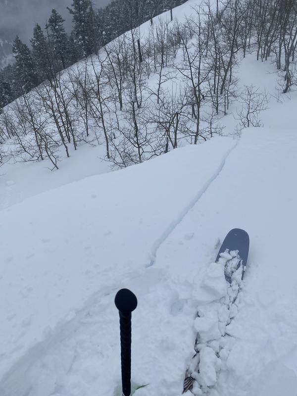
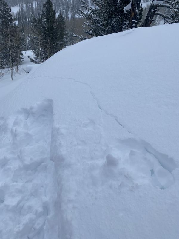
Pictured: cracking and wind loading/ cornice formation.
Today's Observed Danger Rating
Considerable
Tomorrows Estimated Danger Rating
Considerable