Join us at our 2nd Annual Blizzard Ball

Observation: City Creek Peak

Observation Date
1/20/2023
Observer Name
Dempsey
Region
Southwest » Tushers » City Creek Peak
Location Name or Route
City Creek Peak
Weather
Sky
Broken
Precipitation
Light Snowfall
Wind Speed
Calm
Weather Comments
Cold day, broken clouds, intermittent snow flurries and the sun peeked through from time to time.
Snow Characteristics
New Snow Depth
2"
New Snow Density
Low
Snow Surface Conditions
Powder
Snow Characteristics Comments
About 2 inches of new snow on top of the 13" of storm snow from earlier this week.
Red Flags
Red Flags
Poor Snowpack Structure
Red Flags Comments
No cracking, collapsing or avalanche activity observed (however, see below for a report of an avalanche in the Tushars on the PWL 6-10 days ago). Several dry loose 1-2" deep point releases noted on steep terrain. Today I spoke I spoke with a guide in the area who said there was an avalanche that failed on the PWL 6-10 days ago between Eagle Point Resort and Puffer Lake on a north facing slope. 5' crown. Not sure if this occurred naturally or with an explosive or what. In the context of that discussion the guide stated he recommended staying low angle. In the North facing pit I dug Monday the PWL is buried under 6' of snow and on the west facing slope from today the PWL is buried under 4.5 feet of snow. Given the Tushars reputation for high wind and overall less snowpack than other parts of Utah (in particular the marquee Wasatch range), this PWL may be buried under less snow in certain areas and therefore easier to trigger relative to other areas in Utah.
Avalanche Problem #1
Problem
Wind Drifted Snow
Trend
Same
Problem #1 Comments
There was evidence of wind transport on higher slopes and in wind-favored areas. On higher slopes (above treeline) viewed in the distance there were clear dune like wind formations and I would bet there are some sensitive wind slabs up there. In other wind-favored areas such as around trees and in open fields there was some wind transport occurring. Mainly things looked pretty peaceful in the area I was in with mostly undisturbed fresh snow and snow sticking to the trees, especially on north facing slopes. Other aspects of trees snow would be somewhat stripped I believe on the south side of trees.
Avalanche Problem #2
Problem
Persistent Weak Layer
Trend
Decreasing Danger
Problem #2 Comments
Today I spoke I spoke with a guide in the area who said there was an avalanche that failed on the PWL 6-10 days ago between Eagle Point Resort and Puffer Lake on a north facing slope. 5' crown. Not sure if this occurred naturally or with an explosive or what. In the context of that discussion the guide stated he recommended staying low angle.
In the North facing pit I dug Monday the PWL is buried under 6' of snow and on the west facing slope from today the PWL is buried under 4.5 feet of snow.
No collapsing, cracking, or avalanche activity noted on tour. 1-2" deep dry loose point releases observed on steep terrain.
Given the Tushars reputation for high wind and overall less snowpack than other parts of Utah (in particular the marquee Wasatch range), this PWL may be buried under less snow and therefore easier to trigger relative to other areas in Utah.
Snow Profile
Elevation
10,500'
Slope Angle
14°
Comments
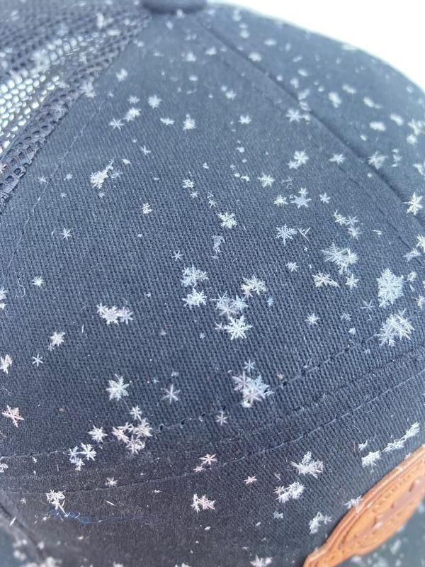
below is a photo of some of the flakes falling in the on and off flurries throughout my tour.
Video
below is a photo of the 2mm rounding facets in the 0-40 cm layer.
Today's Observed Danger Rating
Moderate
Tomorrows Estimated Danger Rating
Moderate