Observation Date
1/16/2023
Observer Name
Champion, Manship
Region
Salt Lake » Parleys Canyon » Lambs Canyon
Location Name or Route
Lambs Canyon
Comments
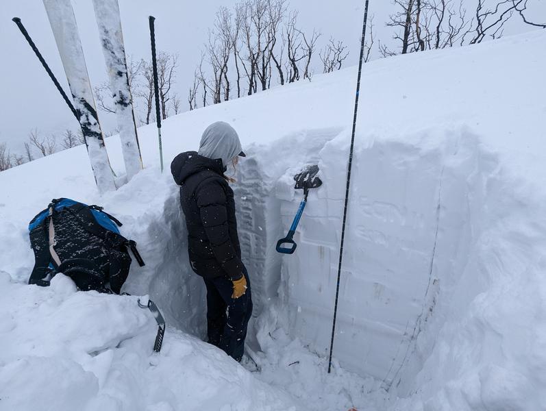
Headed out to check out the stability and snow depth in the Lambs Canyon zone. We know that the overall snow depths have been shallower than the Upper Cottonwoods, but we were surprised to find snow depths between 1.5M to 1.8M between 7500'-8100'. While we began our tour in mild, warm temperatures and good visibility, the snowfall and overcast skies moved in around midday. The warm snow was lightly falling, and wind speeds were light to moderate gusts. I didn't note any signs of transport actively occurring, but ridgelines had notable cornices.
We stuck our shovels in the snow on an NW aspect at 8100', while we still found a generally poor snowpack structure, it was challenging to shovel through the firm snow to get down to the facets below. The facets near the ground showed signs of healing. We were unable to get any propagation or results on the old November snow. While we continue to echo this, I think we are moving in the right direction. Outlier zones have been the main question mark, and it was a good sign to see the snowpack gaining both strength and depth. Moving into the next storm system, I would expect the main instability to be within the wind-drifted snow, or new snow for this zone.
Today's Observed Danger Rating
Moderate
Tomorrows Estimated Danger Rating
Moderate
Coordinates


