Sign Up for the Utah Snow and Avalanche Workshop (USAW) on December 7th!

Observation: Mill D North

Observation Date
1/8/2023
Observer Name
CBrown
Region
Salt Lake » Big Cottonwood Canyon » Mill D North
Location Name or Route
Mill D North
Weather
Sky
Few
Wind Direction
Southwest
Wind Speed
Moderate
Weather Comments
Weather forecast verified today. Increasing winds and increasing clouds through the day. Few in the early am increasing to almost OVC around 14:00. Winds increased to mode by after noon on 9k' ridge lines, gusting higher.
Snow Characteristics
Snow Surface Conditions
Powder
Dense Loose
Wind Crust
Snow Characteristics Comments
Good settled powder in sheltered areas, upside down wind slab skiing in many places. Some thin crust on steeper southerlies from yesterdays sun.
Red Flags
Red Flags
Recent Avalanches
Wind Loading
Cracking
Red Flags Comments
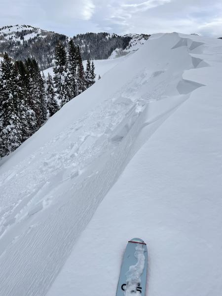
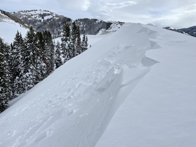
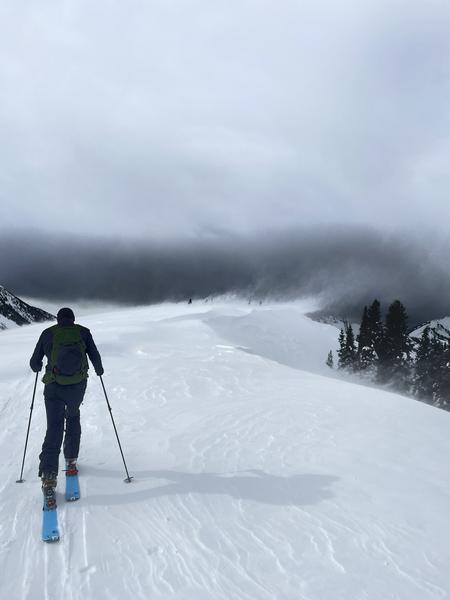
The Avalanche forecast verified as well. As mentioned in the forecast, and as expected with the winds and wind loading, wind slab was obvious today. Wind-pressed slabs in slightly protected windward slopes and SS and HS wind slabs on lee slopes up to about 2' deep. Reactive on slopes >35*. Small avalanches were noted at 9,200' N between the top of short swing and PP3. Trigger unknown, either natural from loading, cornice triggered, or skier/rider kicked the cornice off to trigger. Recently at 11:00. Cornice was actively growing and soft, sensitive, and breaking back further than apparent.
Avalanche Problem #1
Problem
Wind Drifted Snow
Problem #1 Comments
Active and reactive.
Comments
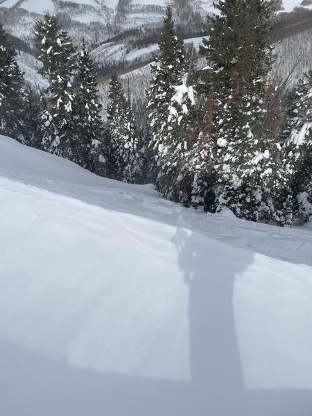
Pictures of the small ~2' deep avalanches near the top of short swing/PP3, and pictures of wind loading/active transport.
Today's Observed Danger Rating
None
Tomorrows Estimated Danger Rating
None
Coordinates