Sign Up for the Utah Snow and Avalanche Workshop (USAW) on December 7th!

Observation: Beaver Mountain Backcountry

Observation Date
12/31/2022
Observer Name
Richie Schumacher
Region
Logan » Beaver Mountain Backcountry
Location Name or Route
Beaver mtn backcountry
Weather
Sky
Overcast
Precipitation
Moderate Snowfall
Wind Direction
Southwest
Wind Speed
Moderate
Weather Comments
Driving up Logan canyon this morning, heavy rain from 5000’- about 6000’ where is transitioned to sleet. Snowing above 6500’. SW winds moderate to borderline strong early this morning (see video) Snow and winds died down as the day progressed. Lots of snow transport noted (see video)
Snow Characteristics
New Snow Depth
8"
New Snow Density
High
Snow Surface Conditions
Powder
Snow Characteristics Comments
Surface conditions are heavy new snow and wind drifted/affected snow. 4-6” new, heavy snow at 7000’, 8-9” of the same with wind affect at 8800’ with some wind drifting of 6-12".
Red Flags
Red Flags
Recent Avalanches
Heavy Snowfall
Wind Loading
Cracking
Rapid Warming
Poor Snowpack Structure
Red Flags Comments
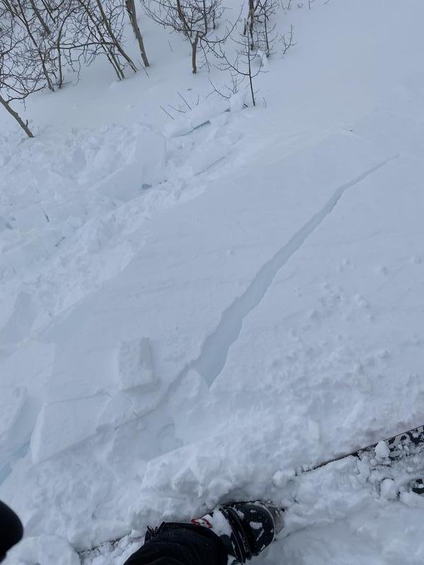
Lots of wind loading and blowing snow seen. Soft to medium density winds slabs of 6-12” seen with cracking at skis. Cornice formation seen on east and SE aspects with some refrigerator sized blocks kicked off. On the drive up Logan canyon, lots of wet loose activity noted from rain on snow.
Video
Picture- cracking and cornice fall. Video 1- wind. Video 2- blowing snow
Video
Today's Observed Danger Rating
High
Tomorrows Estimated Danger Rating
High