Sign Up for the Utah Snow and Avalanche Workshop (USAW) on December 7th!

Observation: Timpanogos

Observation Date
12/24/2022
Observer Name
Kelly, UDOT Provo
Region
Provo » Timpanogos
Location Name or Route
East Timp
Weather
Sky
Broken
Wind Direction
Southwest
Wind Speed
Light
Weather Comments
Sky cover was broken to obscured in clouds. Winds were calm to light from the southwest. No new precipitation fell during the tour.
Snow Characteristics
New Snow Depth
1"
New Snow Density
High
Snow Surface Conditions
Wind Crust
Snow Characteristics Comments
A trace of new snow overnight. Snow surface was damp with greenhousing and rollerballs on steeper solar aspects isolated to the new snow. The dirt layer was present on leeward aspects under the wind slab and on windward aspects the dirt layer was visbile on the surface.
Red Flags
Red Flags
Poor Snowpack Structure
Red Flags Comments
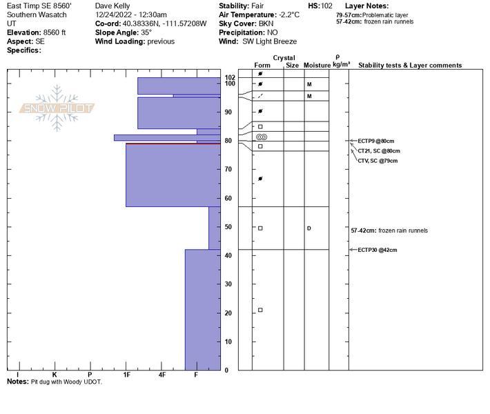
Snowpack structure was poor with harder (finger hardness) snow over weaker snow. Not currently a problem avalanche wise and depending on new snow and wind loading will be worth watching as future storms arrive. Previous wind loading noted. In some north facing aspects we noted evidence of old avalanches where there was a thin wind slab on top of weaker faceted snow. We also noted places where avalanche debris was still a couple feet off the snow surface on the uphill sides of the trees.
Snow Profile
Aspect
North
Elevation
8,900'
Slope Angle
18°
Comments
Snowpit on a southeast facing aspect at 8560'. Slope angle was 35 degrees
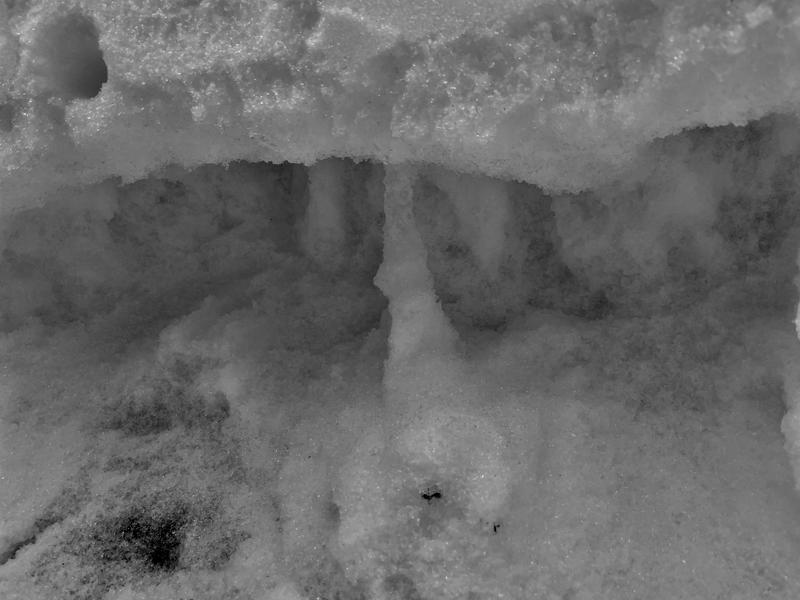
Second Photo-rain runnels in the lower portion of the snowpack within the facets
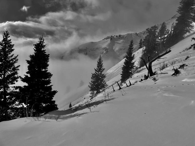
Third Photo- Cloud cover with roller balls on solar aspects
Today's Observed Danger Rating
Moderate
Tomorrows Estimated Danger Rating
Moderate
Coordinates