Observation Date
12/23/2022
Observer Name
Gagne/Costa/Little
Region
Ogden » Ben Lomond » Cutler Ridge
Location Name or Route
Cutler Ridge / Cutler Basin
Weather
Sky
Obscured
Wind Direction
West
Wind Speed
Light
Weather Comments
Very short period of riming.
Snow Characteristics
Snow Surface Conditions
Dense Loose
Wind Crust
Snow Characteristics Comments
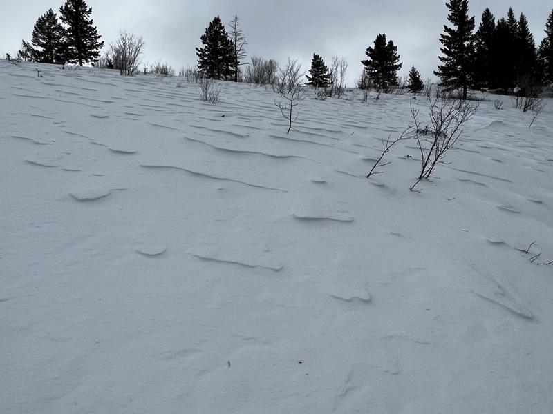
Pretty much all of the terrain adjacent to Cutler Ridge has been wind-affected. There are some low-elevation, wind-sheltered aspects with pockets of dense snow.
HS 120 cms at 7,000' and 150 cms at 8,000'
Red Flags
Red Flags
Wind Loading
Red Flags Comments
Widespread pencil hard wind drifts on most aspects. These drifts were shallow - up to 15 cms (6") and mostly smaller pockets. On most slopes, the drifts would only crack around your skis and not propagate very widely. Although the wind slabs weren't that reactive, they are sitting on top of weaker, lower-density snow and may be still be reactive for another day or so.
Avalanche Problem #1
Problem
Wind Drifted Snow
Trend
Decreasing Danger
Problem #1 Comments
Pockets of hard wind-drifted snow were found on all aspects at the mid and upper elevations. These drifts were on top of weaker, lower-density snow.
Avalanche Problem #2
Problem
Persistent Weak Layer
Trend
Decreasing Danger
Problem #2 Comments
The PWL is buried down 100 cms above 7,500 and we could not get any fracturing on this PWL with extended column tests. The PWL is weaker (F-hard) at lower elevations and gains strength (4F+) at higher elevations where there is a deeper and stronger snowpack on top of the PWL.
Comments
The following video describes the PWL and how it is spatially variable. Overall, I was quite pleased with the snowpack above 7,500' as it appears to be moving in the right direction as the weak layer continues to gain strength.
Snow surface is another thing with widespread wind affected snow making for challenging ski conditions.
Video
Danger was moderate where we traveled (up to 8,400').
Today's Observed Danger Rating
Moderate
Tomorrows Estimated Danger Rating
Moderate
Coordinates