Observation Date
12/21/2022
Observer Name
Greg Gagne
Region
Salt Lake » Little Cottonwood Canyon
Location Name or Route
Upper LCC Periphery
Weather
Sky
Obscured
Precipitation
Light Snowfall
Wind Direction
Southwest
Wind Speed
Strong
Weather Comments
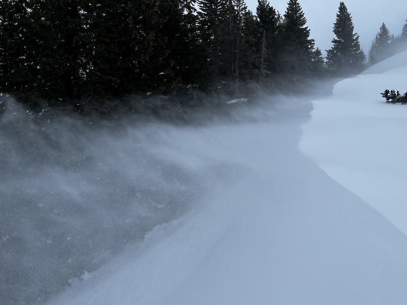
Windy. Some graupel at times.
Snow Characteristics
New Snow Depth
1"
New Snow Density
High
Snow Surface Conditions
Dense Loose
Wind Crust
Snow Characteristics Comments
Maybe a cm or two of dense graupel, but hard to tell with such strong winds.
Red Flags
Red Flags
Recent Avalanches
Wind Loading
Cracking
Poor Snowpack Structure
Red Flags Comments
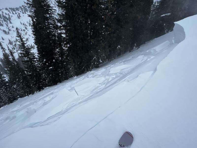
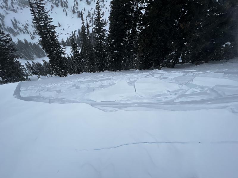
Cracking in fresh wind drifts and remotely-triggered wind drift that propagated to a cornice fall.
Avalanche Problem #1
Problem
Wind Drifted Snow
Trend
Increasing Danger
Problem #1 Comments
Strong winds from the southwest were drifting snow on mostly leeward aspects facing north through east, but strong winds such as this can work around terrain and I was also finding some dense drifts on west aspects. Fresh drifts will be found along exposed ridges, but also well down off of ridgelines.
Avalanche Problem #2
Problem
Persistent Weak Layer
Trend
Increasing Danger
Problem #2 Comments
On NW/N/NE/E/SE aspects where there is a PWL problem, drifting will create an additional stress on this buried PWL. I'm more concerned about drifting on the PWL outside of the upper Cottonwoods where the snowpack is thinner and the PWL is weaker.
Comments
Strong winds were the issue today, with widespread cracking. The fresh wind drifts were reactive because they were forming on top of weaker snow at the snow surface: some surface hoar, near-surface facets, and stellars that were preserved during this period of cold weather.
Video
Today's Observed Danger Rating
Considerable
Tomorrows Estimated Danger Rating
Considerable
Coordinates


