Sign Up for the Utah Snow and Avalanche Workshop (USAW) on December 7th!

Observation: Bloomington Peak

Observation Date
12/19/2022
Observer Name
Daniel Turner
Region
SE Idaho » Bloomington Canyon » Bloomington Peak
Location Name or Route
Bloomington Peak
Weather
Sky
Clear
Wind Direction
Southwest
Wind Speed
Moderate
Weather Comments
Clear and cold with moderate winds throughout the day. Ridgelines were uncomfortable as the windchill was in the negatives.
Snow Characteristics
New Snow Depth
4'
Snow Surface Conditions
Powder
Dense Loose
Wind Crust
Snow Characteristics Comments
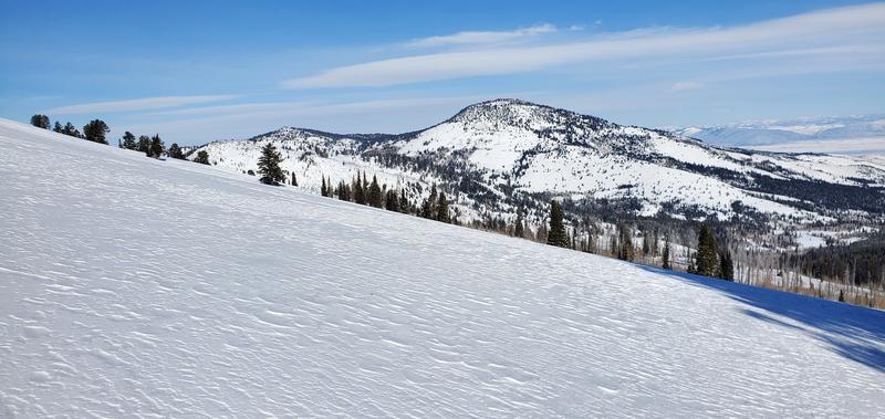
Moderate to strong overnight winds have affected the snow surface on the wind word and lee word slopes. Pockets of good low-density snow exist in sheltered areas. We rode Southerly low angle slopes in wind sheltered areas. riding conditions were cold but good.
Red Flags
Red Flags
Wind Loading
Cracking
Collapsing
Red Flags Comments
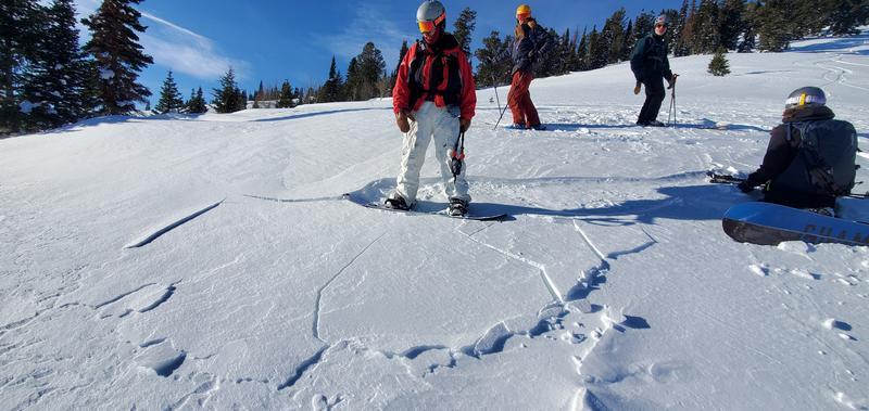
We experienced one large whoomph on a low-angle SE slope. We also kicked loose a small wind slab on a SE slope around 8000'
Avalanche Problem #1
Problem
Persistent Weak Layer
Trend
Decreasing Danger
Problem #1 Comments
We were able to identify the PWL on a SE slope around 9000'. 1mm Facets at 50cm from the ground. This layer was not particularly reactive STM
Avalanche Problem #2
Problem
Wind Drifted Snow
Trend
Same
Problem #2 Comments
Moderate to Strong winds on the ridgelines are definitely transporting the recent storm snow.
Snow Profile
Aspect
Southeast
Elevation
9,000'
Slope Angle
20°
Comments
A quick pit identified a PWL at 50cm.
Small Winds Slab near ridge line.
Wide spread wind effect throughout our tour
Today's Observed Danger Rating
Moderate
Tomorrows Estimated Danger Rating
Moderate
Coordinates