Observation Date
12/16/2022
Observer Name
Staples
Region
Uintas » Weber Canyon
Location Name or Route
Moffit Creek and Shingle Mill Flat
Comments
Today I was in both upper Moffit Creek and on Shingle Mill Flat. On Shingle Mill Flat, I remotely triggered this avalanche which was confirmation of how dangerous northerly aspects are.
Northerly aspects are easy because they are simple dangerous and more avalanches are likely.
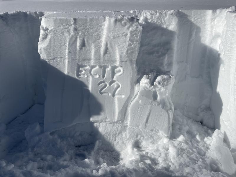
It's the other aspects that we've been spending more time assessing. Today I dug on a southeast facing slope and a west facing slope. Of note, in both of my pits I got an ECTP22 (it took 22 taps for the weak layer to collapse and propagate a crack across the column). JG got the exact same score on a NW facing slope at 10,000 ft somewhere in upper Weber Canyon
Below is a profile and photos from the West facing slope at 9150'. At a similar aspect and elevation, I saw a slope where a moose had triggered a collapse/crack and released a tiny piece of snow. Notice the crack above the slope under the moose tracks and the small piece of slab that released.


Below is a photo of a pit I dug on a southeast facing slope at 8700 ft.
Coverage is unbelievable. South aspects have so much snow.
First photo shows how much the new snow has settled (or compressed) by the settlement cones around the saplings.
Second photo shows how much new snow there is.
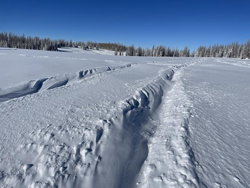
Third photo shows evidence of some northerly winds last night.


Today's Observed Danger Rating
Considerable
Tomorrows Estimated Danger Rating
Considerable
Coordinates


