Sign Up for the Utah Snow and Avalanche Workshop (USAW) on December 7th!

Observation: Reynolds Pk

Observation Date
12/10/2022
Observer Name
Brett Carroll
Region
Salt Lake » Big Cottonwood Canyon » Reynolds Pk
Location Name or Route
Mt Reynolds area
Red Flags
Red Flags
Recent Avalanches
Wind Loading
Cracking
Collapsing
Poor Snowpack Structure
Avalanche Problem #1
Problem
Wind Drifted Snow
Trend
Increasing Danger
Problem #1 Comments
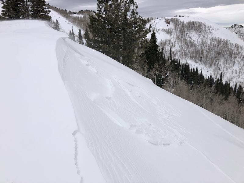
Lots of wind transport around Mt Reynolds today, with sustained strong winds and extreme gusts on ridgelines as low as 9000' and even some evidence of transport well down into drainages. Winds mostly out of the S and SW, but also a fair amount of swirling resulting in loading on many aspects. Fresh wind drifts were touchy to very touchy. I experienced cracking in several locations, and remotely triggered a very small avalanche from about 15' away while approaching a small test slope. The avalanche was up to 8" deep, about 25' wide, ran about 30', and occured on the NE side of a ridge at 8900' (above Big Water Glade). Photo below
Avalanche Problem #2
Problem
Persistent Weak Layer
Trend
Same
Problem #2 Comments
Persistent weak layer being persistent... No signs of instability on this layer observed, but its presence is enough. We'll see how much more reactive it becomes during/after the incoming storm.
Today's Observed Danger Rating
Considerable
Tomorrows Estimated Danger Rating
Considerable
Coordinates