Observation Date
12/9/2022
Observer Name
Staples / Kelly / Meisenheimer
Region
Provo » Snake Creek » Ant Knolls
Location Name or Route
Snake Creek to Pole Line Pass
Weather
Sky
Overcast
Precipitation
Light Snowfall
Wind Direction
Southwest
Wind Speed
Light
Weather Comments
Snow was in and out with the clouds for most of our day. The new snow only added a trace to maybe an inch or two. Temperatures remained cold, and winds blew from the southwest.
Snow Characteristics
New Snow Depth
15"
New Snow Density
Low
Snow Surface Conditions
Powder
Faceted Loose
Wind Crust
Snow Characteristics Comments
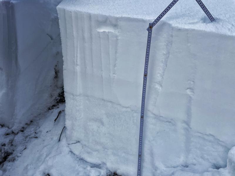
Most all aspect and elevations were holding dry cold powder that sits above a weak layer of faceted snow.
Red Flags
Red Flags
Recent Avalanches
Wind Loading
Cracking
Collapsing
Poor Snowpack Structure
Red Flags Comments
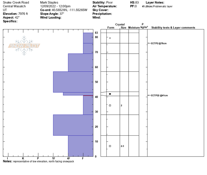
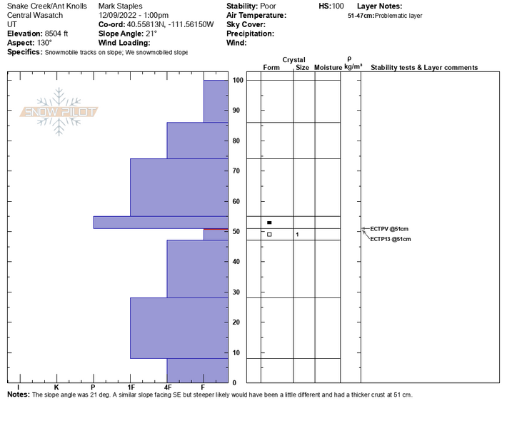
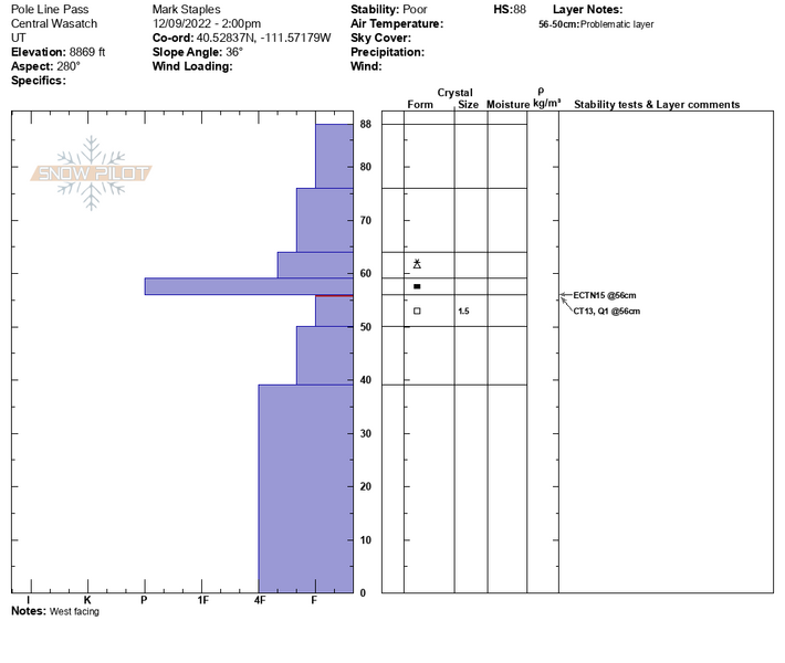
Most of the terrain we traveled through was not steep enough to avalanche. However, we got many collapses and shooting cracks from road cuts/banks. ECT test scores continued to show propagation.
Avalanche Problem #1
Problem
Persistent Weak Layer
Trend
Increasing Danger
Problem #1 Comments
The weak layer is well preserved across many aspects and elevations; what varies is the slab of snow sitting on top. Some areas only have 10-15" of snow above the weak layer, while others have 1-3' of snow over the weak layer from the strong southerly winds. With more wind and heavy snowfall, the Ant Knolls area will likely experience a widespread natural avalanche cycle
I would continue avoiding slopes steeper than 30°.
Comments
This profile was dug just off the road and likely was already collapsed before we showed up. We tried to dig on as many aspects and elevations as possible to map the weak layer. As noted above, everywhere we put our shovels in the snow, we could find weak faceted snow; there is no shortage.
Video
Today's Observed Danger Rating
Considerable
Tomorrows Estimated Danger Rating
Considerable
Coordinates