Observation Date
12/7/2022
Observer Name
Ted Scroggin
Region
Uintas » Whitney Basin
Location Name or Route
Whitney Basin
Weather
Sky
Few
Wind Direction
Southeast
Wind Speed
Light
Weather Comments
A chilly morning in Evanston with single digit temperatures and a slight east wind made for a cold start to the day. The temperatures slowly increased on the drive to the trailhead and it was a nice mild and calm day on the forest.
Snow Characteristics
New Snow Depth
6"
Snow Surface Conditions
Powder
Snow Characteristics Comments
Monday's little refresher storm delivered about 6" or so around the Whitney area and conditions were mostly nice soft powder and the riding and turning are slowly getting better with each storm.
Red Flags
Red Flags
Collapsing
Poor Snowpack Structure
Red Flags Comments
No recent avalanches that I observed today, but the snow pack structure is still a red flag. The mid-pack weak sugary snow is very easy to locate under a couple feet of snow. The places I dug today the slab is slightly denser than the weak faceted snow underneath. I did experience one good rolling collapse as I traveled along the ridge line where recents winds have put a dense wind slab on top of weak sugary snow.
Avalanche Problem #1
Problem
Persistent Weak Layer
Trend
Same
Problem #1 Comments
The poor snow pack structure does not appear to be going anywhere soon, there is lots of weak faceted snow around the area some of it just a couple feet below the surface.
Comments
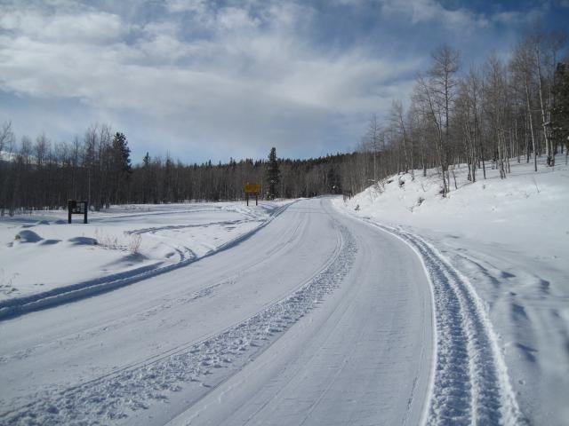
The conditions are slowly improving with each storm and the coverage is quite good for early December. The groomer made the first trip into Whitney last night and the trail was in great shape this morning.
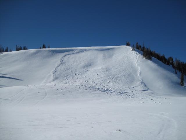
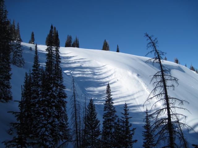
No recent avalanche activity, but a couple pictures of an avalanche cycle from the past weekend. This is a northeast facing slope that gets a lot of heavy wind loading form southerly winds.
Today's Observed Danger Rating
Considerable
Tomorrows Estimated Danger Rating
Considerable
Coordinates