Observation: Duchesne Ridge

Observation Date
11/30/2022
Observer Name
Nassetta, Manship, Duetchlander
Region
Uintas » Duchesne Ridge
Location Name or Route
Dueschene Ridge
Weather
Weather Comments
A beautiful day in the Uintas as the recent storms and associated weather have cleared. A few clouds, with light to moderate winds for the morning with temps in the low 20's at 10k. With the days progression, winds continued to ramp up and shift to the south, and eventually coming from the southeast at moderate speeds before we boogied around at 1500.
Snow Characteristics
New Snow Depth
10"
New Snow Density
Low
Snow Surface Conditions
Powder
Snow Characteristics Comments
Riding conditions continue to improve, and travel is becoming easier on the sled, skis or anything that slides on snow.
The pack has lost some body with weak, sugary, faceted snow sitting underneath the most recent storm delivery. Although height of snow (HS) has increased, the low-density snow received did very little to float us above the terrestrial hazards that continue to creep beneath our sleds and skis.
A little settlement heading into the next storm should help to set us up moving forward. Nonetheless, great skiing and riding for the last day of November!
Red Flags
Red Flags
Recent Avalanches
Wind Loading
Cracking
Collapsing
Poor Snowpack Structure
Red Flags Comments
From recent avalanches, to cracking and collapsing, and remotely collapsing slopes all the red flag indicators were there for todays avalanche hazards. Each time my track punches through and spins in the sandbox, or my skis or board dive down under the snowpack, it's a tell tale sign of poor snowpack structure, and weak sugary snow lurking below!
Avalanche Problem #1
Trend
Increasing Danger
Problem #1 Comments
Wind-drifts are good indicators of wind slab avalanche problems, and they were everywhere! Small wind pillows and wind-loaded slopes were easily triggered underneath our sleds and skis.
Avalanche Problem #2
Problem
Persistent Weak Layer
Trend
Increasing Danger
Problem #2 Comments
Although perhaps not on the list, I am a keying in on our persistent weak layer, and the trend of increasing danger for persistent slab avalanches. Prior to this last storm system, sugary, faceted snow was widespread at mid-upper elevations on nearly all aspects.
The recent storm snow combine with wind formed soft slabs, not greater than four-finger hand-hardness. Almost all avalanches we noted today were failing on persistent grains and were 10"-2' in depth. Some slopes produced pockets, while others had more connectivity.
Comments
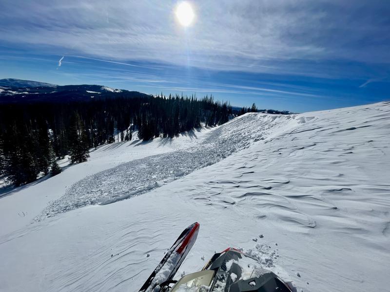
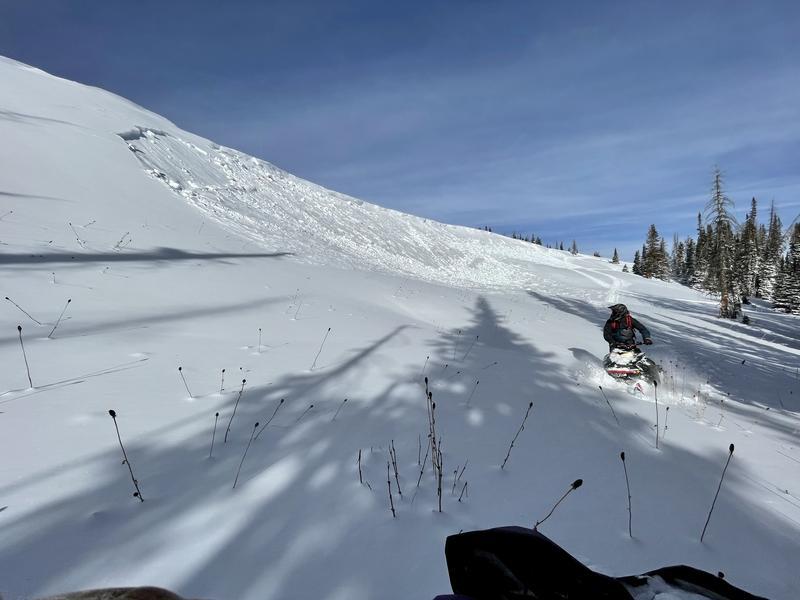
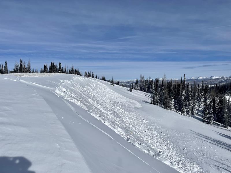
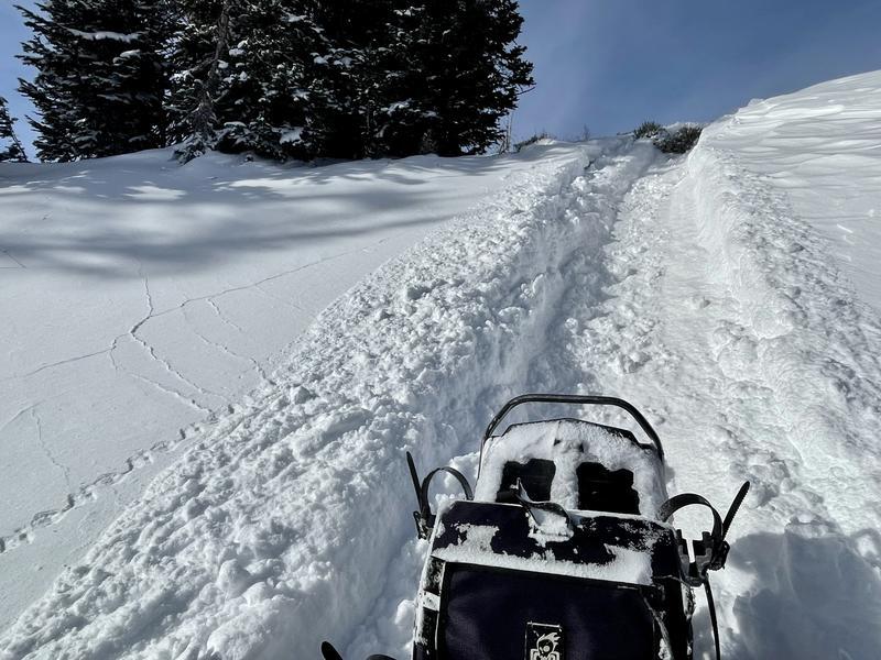
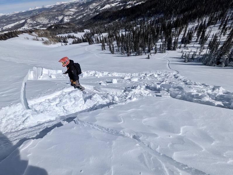
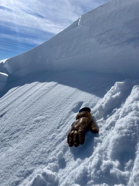
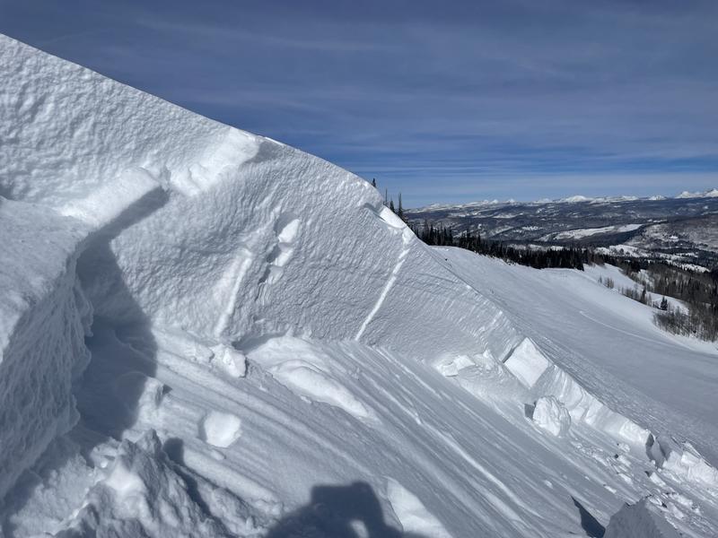
Photos are from travels today along the Dueschene Ridgeline, noting multiple avalanches on SE through N aspects at upper elevations.
Today's Observed Danger Rating
Moderate
Tomorrows Estimated Danger Rating
Moderate
Coordinates