Observation Date
11/9/2022
Observer Name
Hardesty and Powder Mountain Snow Safety
Region
Ogden » Powder Mountain
Location Name or Route
Powder Mountain
Comments
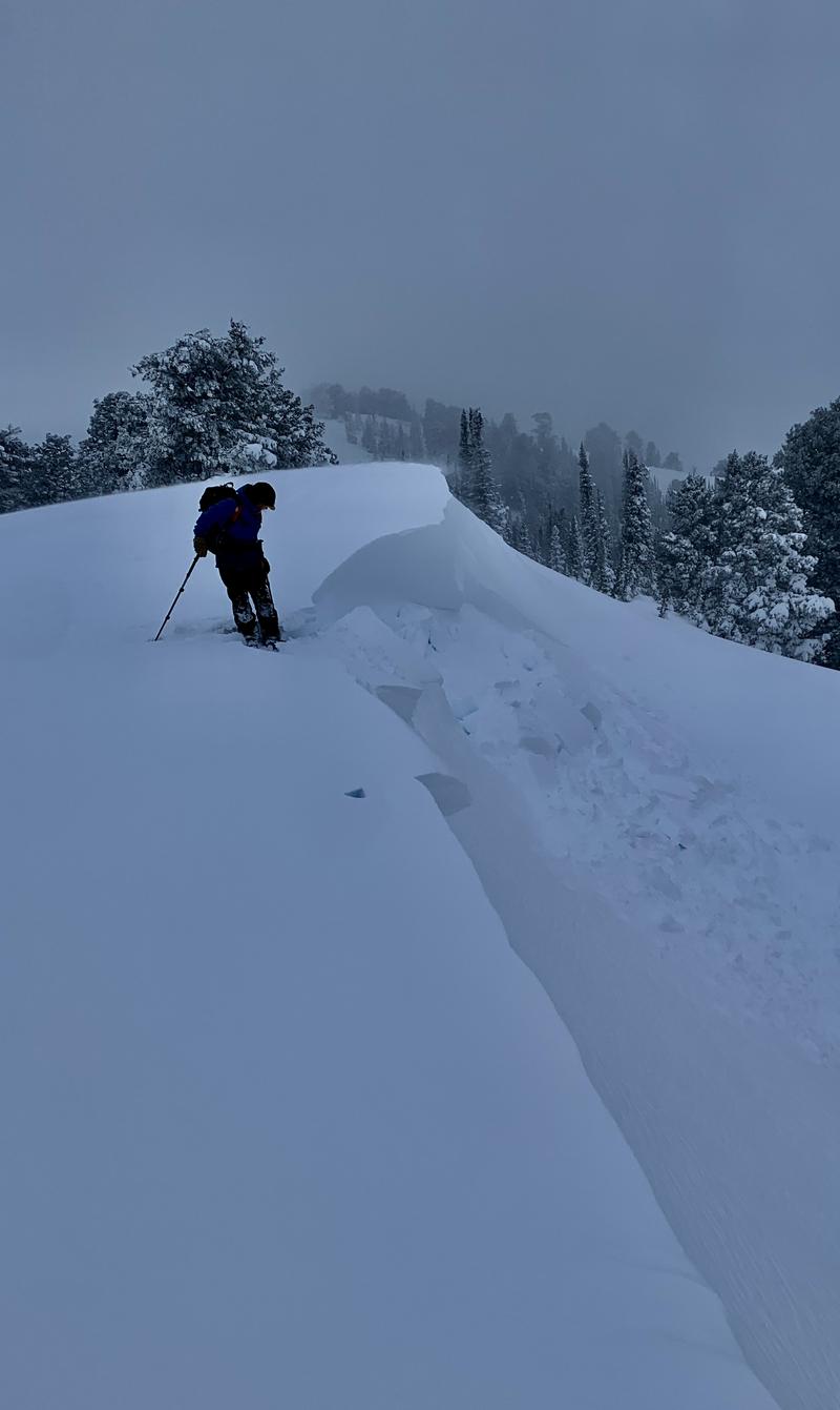
Evidence of natural cornice fall triggering shallow size 1 soft slabs of windblown snow to the lee of ridges and subridges. Easy to initiate the same.
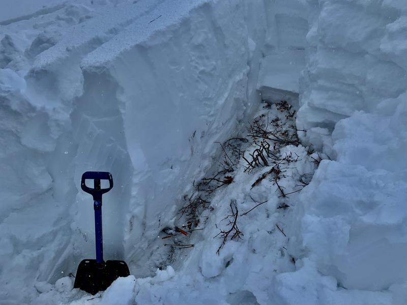
15cm of damp small facets (4F) are at the ground level. Facets are small, warm, and damp. ECTX........HOWEVER, two PSTs suggest potentially unstable snow (see profile above). With significant snow and wind loading, we stayed on low angle terrain but this layer will be something to watch. No cracking or collapsing noted.
PST - note position of saw.

For Thursday, wind and new snow instabilities will still exist. The buried facets should continue to be monitored with caution recommended in steep northerly terrain.
Today's Observed Danger Rating
None
Tomorrows Estimated Danger Rating
None
Coordinates


