Observation Date
3/30/2022
Observer Name
Bruce Tremper
Region
Salt Lake » Little Cottonwood Canyon » Grizzly Gulch
Location Name or Route
Grizzly Gulch
Weather
Sky
Few
Wind Direction
Northwest
Wind Speed
Light
Weather Comments
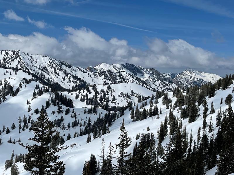
Stunning day with brilliant spring sunshine with photogenic post-storm clouds dancing around some of the peaks.
Snow Characteristics
New Snow Depth
5"
New Snow Density
High
Snow Surface Conditions
Powder
Wind Crust
Damp
Snow Characteristics Comments
The welcome colder temperatures and new snow made for some decent turning conditions but the new snow was fairly dense, mostly graupel, and the strong spring sun began to make it damp by afternoon. You could feel the frozen crust underneath. The northwest winds reportedly blew fairly hard from the northwest in the morning but I got a crack of noon start and they had died down mostly by the time I arrived. You could see and feel that the wind had eroded much of the new snow off of the northwest facing terrain and there was some minor wind drifting of new snow.
Red Flags
Red Flags
Wind Loading
Red Flags Comments
Just a quick observation from a quick couple runs in Grizzly Gulch, one to Honeycomb Ridge down Black Bess and another from Patsy Marly NW facing. The last couple times I've been out, I dug snowpits on mid elevation north facing slopes before the big warm up these past few days. I wanted to take a look at higher elevations and just get some quick exercise. I did not have time to dig any snowpits but I wanted to just post some general observations. The old snow surface at higher elevations is frozen and solid and hard to get the handle end of the ski pole through it in most places. In any place I probed, I could not feel the distinct, buried January-February drought layer faceted layer that I have found on the mid elevation north facing slopes that were so scary for the past couple weeks. The new snow seemed to be fairly well bonded to the frozen surface and skiers were getting into many of the usual places and not triggering any new snow avalanches that I could see. The snow I skied on was well behaved and stayed in place even when jumping on small, steeper test slopes. I could not see too many wet avalanches from the extremely warm temperatures before this last storm. I could only see some avalanche activity of some kind in Banana Days in Day's Fork that was also noticed by Dave Coyne in his ob. In general, I was pleased to see that the upper elevations were much safer feeling than what I have been seeing a week or two ago on the mid elevation, shady slopes. I'm curious to take a look at them since they got so wet but I just did not have time today.
Avalanche Problem #1
Problem
New Snow
Trend
Decreasing Danger
Problem #1 Comments
New, dense graupel from the recent convective activity was also blown around by the wind along the upper ridges but the wind deposits seemed fairly well bonded to the underlying frozen crust by the time I was there in the afternoon. The snow was not sensitive and I could not get any of it to move by jumping on small test slopes. I'm guessing they were more sensitive yesterday and this morning. Skiers were getting into Wolverine Cirque and many of the other steeeper slopes and not triggering anything.
Avalanche Problem #2
Problem
Wet Snow
Problem #2 Comments
There was obviously lots of wet snow below about 8,500' from the past few days of extremely warm temperatures but I was above those elevations today so I don't have any information to add.
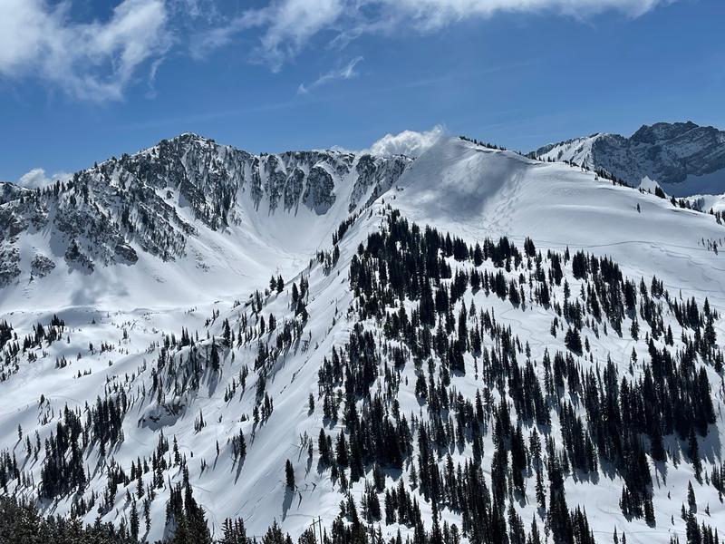
#1 You can see from a distance some kind of avalanche activity in Banana Days in Day's Fork.
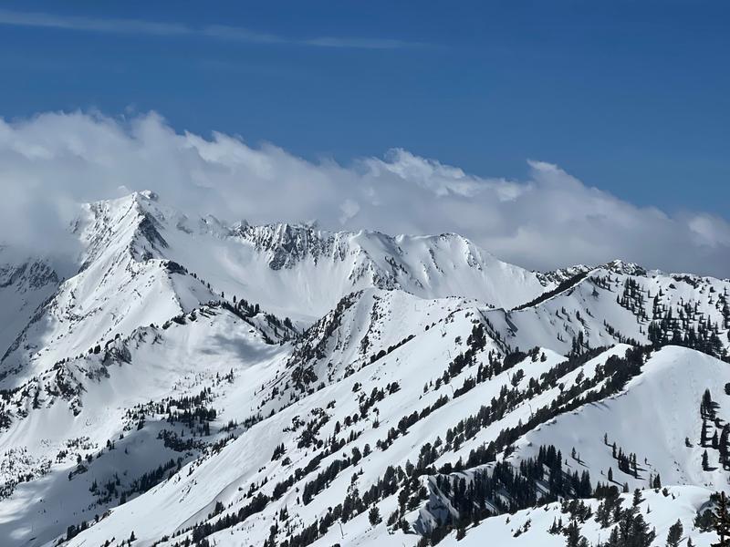
#2 Looking into Cardiac Bowl, Silver Fork, etc. I did not notice any new tracks in Cardiac from a distance but Silver Fork was starting to get skied along with Pole Line Pass, etc.
#3 Looking at Wolverine Cirque and NW facing Patsy Marly with skiers starting to lay down tracks without triggering avalanches.
Today's Observed Danger Rating
Moderate
Tomorrows Estimated Danger Rating
None
Coordinates